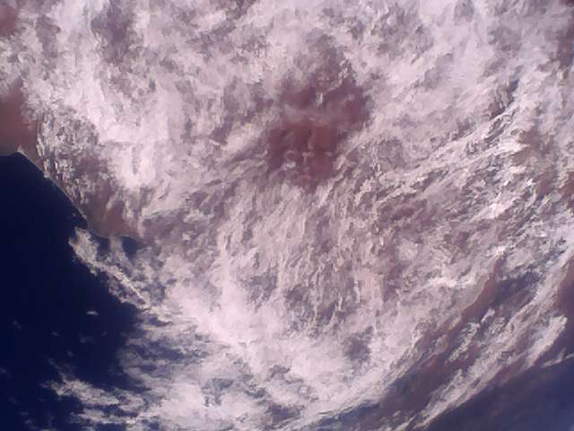
Yesterday I received image from Lucky-7.
1 Like
Unless I am misreading the schedule @geoscan posted higher up this thread, Image 15 was scheduled for last night (13.12.2024) not today.
- 2024-12-14 11:33UTC

Bad decoding here in Brazil ![]()
The signal was relatively strong but for some reason my SoundModem crashed and now I can’t extract the initial packets from my IQ recording (I think there is some initializer packet that I can’t decode)
73’s de PU4ELT ![]()
2 Likes
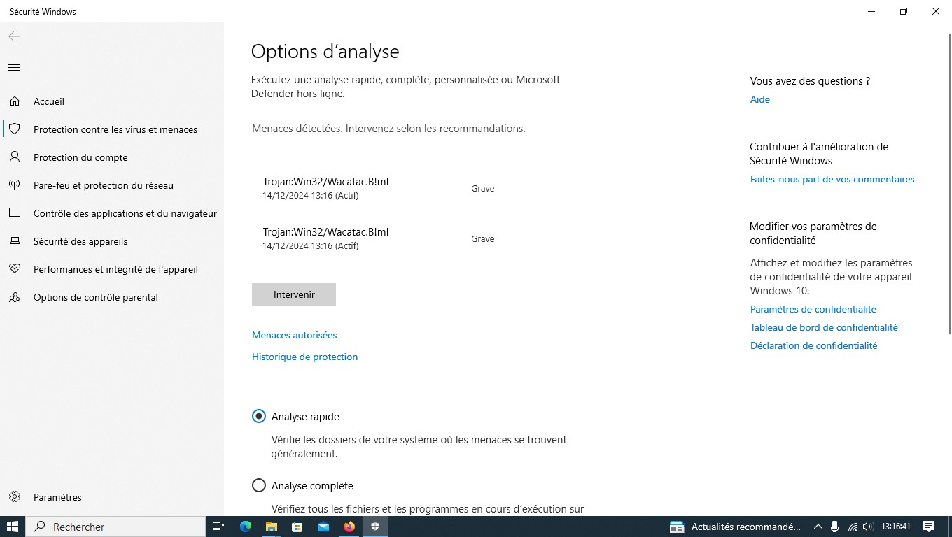
Thanks for sharing, is it possible to see what file(s) should be considered malicious ?
For now my guess is, that this is a false positive but I would like to know more details.
I have found that if you don’t get the first few frames of data then the image will not appear even when you receive the the rest of the image with a good signal.
3 Likes
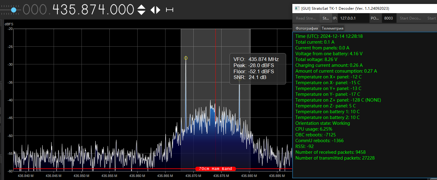
I can receive decent telemetry signals at lower elevation angles (around 6°).
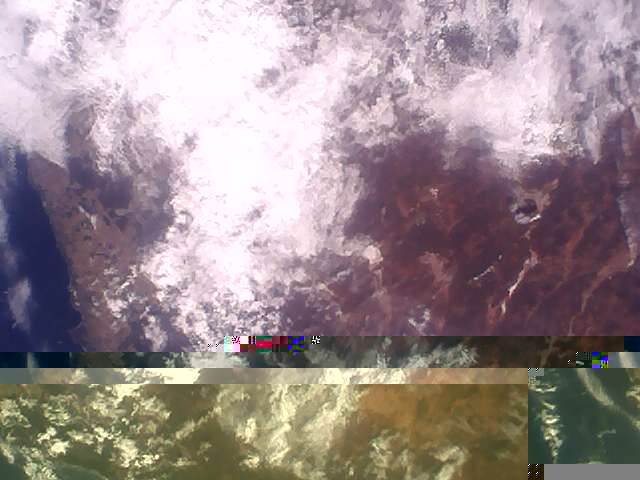
I’m looking forward to receiving a complete image.
2 Likes
19.12.2024 scheduled (UTC Time):
Image 1: 06:13:00 + 06:15:00 + 06:17:00 (-66.81211, 118.86269)
Image 2: 07:57:00 + 07:59:00 + 08:01:00 (-66.55408, 93.01141)
Image 3: 09:23:00 + 09:25:00 + 09:27:00 + 09:29:00; 12:30:00 + 12:32:00 (-62.1910, -58.9871)
Image 4: 16:56:00 + 16:58:00 + 17:00:00 + 17:02:00 (-66.5000, 67.2982)
Image 5: 18:32:00 + 18:34:00 + 18:36:00 (-71.3828, 170.3305)
20.12.2024 scheduled (UTC Time):
Image 6: 07:24:00 + 07:26:00 + 07:28:00 (-65.8447, 123.1295)
Image 7: 09:00:00 + 09:02:00 + 09:04:00 (-65.8447, 123.1295)
Image 8: 10:36:00 + 10:38:00 + 10:40:00 (-69.5866, -0.2908)
Image 9: 16:36:00 + 16:38:00 + 16:40:00; 21:16:00 + 21:18:00 (-77.7335, -41.4172)
Image 10: 18:10:00 + 18:12:00 + 18:14:00 + 18:16:00 (-75.4789, -58.4281)
Image 11: 19:43:00 + 19:45:00 + 19:47:00; 13:47:00 + 13:49:00 (-72.5287, -77.0711)
21.12.2024 scheduled (UTC Time):
Image 12: 05:27:00 + 05:29:00 + 05:31:00 (-69.7324, 75.5159)
Image 13: 07:02:00 + 07:04:00 + 07:06:00 + 07:08:00 (-78.4644, 106.8371)
Image 14: 08:37:00 + 08:39:00 + 08:41:00 (-82.2368, -55.9968)
Image 15: 10:14:00 + 10:16:00 (-73.2368, -1.3968)
Image 16: 16:13:00 + 16:15:00 + 16:17:00 (-80.5, -29.33)
Image 17: 17:46:00 + 17:48:00 + 17:50:00 (-78.4770, -111.8880)
Image 18: 19:20:00 + 19:22:00 + 19:24:00; 20:55:00 + 20:57:00 (-78.4770, -111.8880)
22.12.2024 scheduled (UTC Time):
Image 19: 06:40:00 + 06:42:00 (-33.6387, 147.4080)
Image 20: 08:14:00 + 08:16:00 + 08:18:00 (-74.25, -125)
Image 21: 09:34:00 + 09:36:00; 09:48:00 + 09:50:00 + 09:52:00 + 09:54:00 + 09:56:00 (-76.13, -26.75)
Image 22: 15:52:00 + 15:54:00 + 15:56:00 (-75.33, -72.5)
Image 23: 17:26:00 + 17:28:00 + 17:30:00 (-76.0833, 168.3167)
Image 24: 19:00:00 + 19:02:00 + 19:04:00 (-81.500000, -175.000000)
Image 25: 20:33:00 + 20:35:00 + 20:37:00 (-77.9909, 105.9947)
Image 26: 22:04:00 + 22:06:00 + 22:08:00 (-70.9909, 65.4947)
8 Likes
Had a quick try for the 092x image 3 pass over UK. Wrong side of building really so just a ht in the garden. Mk 1 ear thinks it heard a few beeps & squeaks but nothing decoded. Hopefully better passes later during activation.
Image 7 9:00 UTC Observation #10793492
4 Likes
Image 11 19:42 UTC Observation #10793493

4 Likes
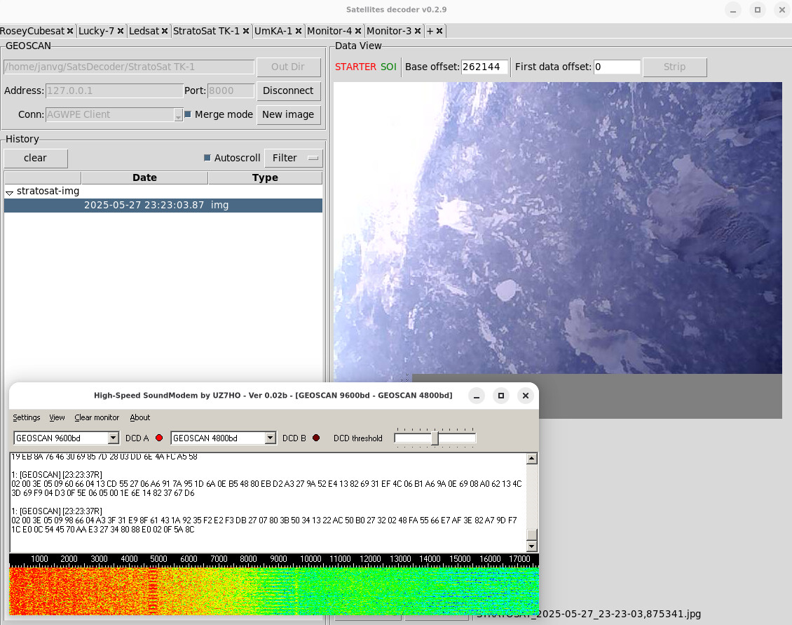
what antenna are you using? I’m struggling to get good reception on this one. I can decode the raw data but not enough to produce an image and was wondering if there is a way to convert the raw data into an image when some of the data is missing.
1 Like
I use a QFH antenna with LNA. With image extraction it is important to additionally process the ogg file and obtain a kss file, and then use SatsDecoder in merge mode to combine the kss files. See the tips above.
1 Like
Many thanks
1 Like
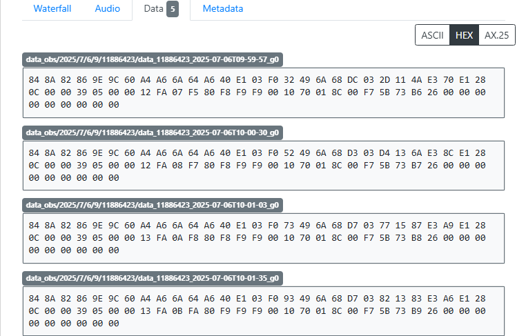
Are these the data files you decode to receive the images and telemetry?
Thank you
1 Like
Coming back at this, I don’t have my own ground station yet. I simply want to able to view images or telemetry from the recorded data on the SatNOGs page(that’s if it’s possible). I installed the same decoding software you used and didn’t even know how to use it.
Any good resources which could help in understanding working with satellites would be much appreciated too.