Thanks for the quick response! I am already working on it, I downloaded the exact 28 missing frames and will try to combine with my data
2 Likes
Ehhhh none of these are over North America…
I managed to get some image from it. Not a very good result considering I had a pretty high signal strength and a high gain yagi. I got the initial missed packets from another observations.
Hopefully once a proper format documentation is released a better decoder can be made that can take advantage of repeated packets

4 Likes
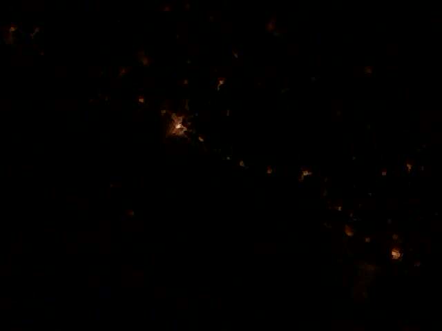
Awesome work. Try to receive an image this evening. It probably will be just a dark image so picture will weight not much and it will be easier to receive full image.
Would be pretty cool to do a night lights photo though…
Could you please share the IQ recording?
what decoding software are you using? Need to try as well.
I used this as the final decoder: GitHub - kng/geoscan-tools: Process frames from satellite Geoscan-Edelveis
But I’m not sure how you would use it properly, I had my data demodulated in gnuradio from the IQ recording and then manually converted into a “KISS” format with 26 more packets downloaded from a different satnogs observation.
My IQ recording does not contain the jpeg headers so will not decode anything on its own. See the reply from PE0SAT above with the link to obs 6805417, you can download the FM demodulated audio there which includes the header as well as a similar amount of image data to mine
I would also like to ask if there’s any updates on the status of the X-band transmitter. Was the original intention to play back stored images on X-band?
1 Like
We want to test our X-Band transmitter first. For now we can transmit just carrier. If you would like to get involved in testing please let us know.
2 Likes
On what frequency will they transmit and when? What polarization ? DVB-S2? QPSK? FEC 9/10, 1M ?
I will be happy to participate in the tests.
1 Like
From what I know (DM from @geoscan ) it’s about 4MHz wide and is GMSK.
Hi! I would be more than happy to participate.
@geoscan As per the asking of multiple people already, is it possible to have a complete datasheet of not only the telemetry (https://download.geoscan.aero/site-files/Amateur%20radio%20telemetry%20protocol.pdf), but the imaging protocol as well? It will do a great service to everyone.
1 Like
One drawback I’ve seen is that the time reported on the observation is something like 30s, so all the observations gets jumbled together and it’s very hard to join all these to one complete.
My suggestion is to allow at least 1min between different images to be able to effectively reassemble them.
The same image can be repeated several times back to back.
I use the stop frame as unique identifier as this is much more unique than the start frame.
If we want to collect distributed data from this I think the frames need some more protocol overhead so it’s possible to distinguish images from eachother. 1 byte image identifier could be sufficient, if there’s some field in the header that can be used it doesn’t have to affect the 56-byte chunks.
THIS. THIS. THIS. Thank you!!
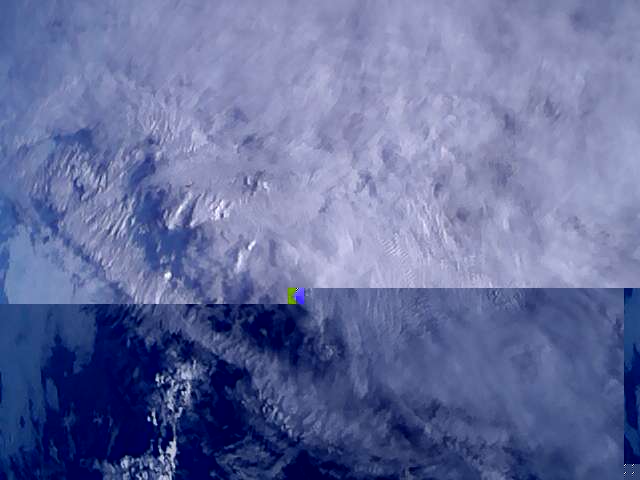
ok, this is as close as I got to a complete image from 2022-11-28
4 Likes
Cloudy Europe. Great work!
And this is from a flight a while ago.
1 Like