a small tip on manually adjusting images with missing frames. use hexer or similar to find the zeroes, then start deleting values on lower addresses, one by one and looking on the resulting image. as the jpeg guide linked earlier said, the 6 byte blocks can be hand tuned to have less impact on the rest of the image.
4 Likes
New image transmissions!
16.01.2023 scheduled (UTC Time):
Image 1: 09:10:15 + 09:12:00 (50.87, 20.22)
Image 2: 10:42:30 + 10:43:20 (0.87, 9.02)
Image 3: 15:23:00 + 15:24:40 + 22:00:00 (64.98, -11.24)
17.01.2023 scheduled (UTC Time):
Image 4: 08:43:00 + 08:45:00 (51.55, 144.49)
Image 5: 10:15:45 + 10:17:51 (42.49, 6.41)
Very strong and solid signal from Geoscan of the transmission 10:42 and 10:43UTC some minutes ago over Madrid Spain. Good image decoding but the camera was not pointing to Earth I assume.

1 Like
Yes. This image was made to see where exactly satellite is pointing on equator. Thank you!
Image from Geoscan-Edelveis mission - #363 by satcolintel5 was made over Madrid 89 grad. pass. Passive orientation works this way, that over Madrid satellite is facing horizon
@SA2KNG Hello!
Regarding SatNOGS Network - Observation 7035202
Looks like image should be received fully. Missed two packets apparently, resulting mostly corrupt image
This pass was out of my footprint. But ussing your mentioned observation and process_simple.py tool I was quite lucky on getting the image. Location? Sajalin Island?

2 Likes
Wow! Amazing! Thank you very much. Yes, this is Sajalin Island:)
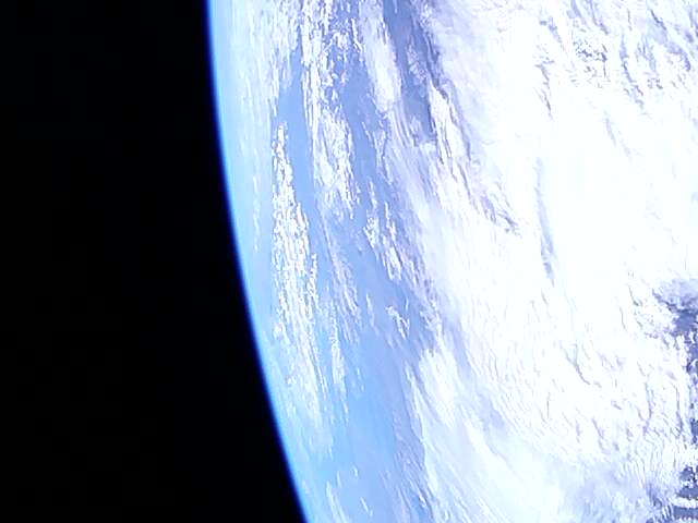
Just received, perfect image from Geoscan transmission 10:15:45 UTC.
73 de EA4SG
2 Likes
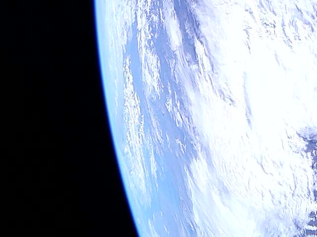
Great! Thank you!
73!
Yep, it is fixed pointing straight up so no tracking normally. good pass anyways.
One feature I would like to try some day is to automatically correct the boundaries to the missing bytes to lessen the effect on the rest of the image. previously discussed in this thread…
1 Like
I have also received that last picture fully automatically using my satnogs station and @SA2KNG post observation decoding. See obs:
https://network.satnogs.org/observations/7035196/#tab-data
And click the top packet, where it reads: “data_obs/2023/1/17/10/7035196/data_7035196_2023-01-17T10-14-36.png”
And it shows:
Isn’t that great!?!?!
Best regards, Eelke.
6 Likes
Looks fantastic!! One thing perhaps to think about is to have it display right in the tab rather than showing the hexadecimal of the png… not sure how that would be done, but it’s already wonderful!!
@geoscan any new image schedules?
We are working currently on small software update to improve image transmissions. We will let you know when it will be ready.
3 Likes
Hi all.
Any plan for transmission for the coming days?
73 de David EA4SG
1 Like
Hello, David!
We are planning to transmit new images in a few days. We will let you know here:)
73!
This is indeed something @sfou has implemented in satnogs-network!1131 and which waits for beeing merged and then deployed to SatNOGS Network.
4 Likes
Hello, Everyone.
We did a little software update. Now image transmissions will be more convenient: they will have different sizes depending on an image size.
We had two test transmissions today.
4 Likes
Image transmission was successful! I was able to get picture after changing offset value in process_simple.py. Here is the image.

4 Likes
Hi, was that image decoded from the data of the observation mentioned in your previous post?
This one:
https://network.satnogs.org/observations/7086008/
It happens to be my station. I am curious! ![]()
1 Like