You may have already noticed the capabilities of the new Geomaps from the dashboards of SNUGLITE and GRBAlpha.
I’ve continued adding Geomaps to the Digipeater Overview dashboard to show the locations of observing stations and those stations transmitting their positions and messages in APRS format.
Until a few weeks ago, those Geomaps displayed APRS transmissions only if uncompressed or compressed encoded.
Since yesterday, they are also showing it if Mic-E encoded.
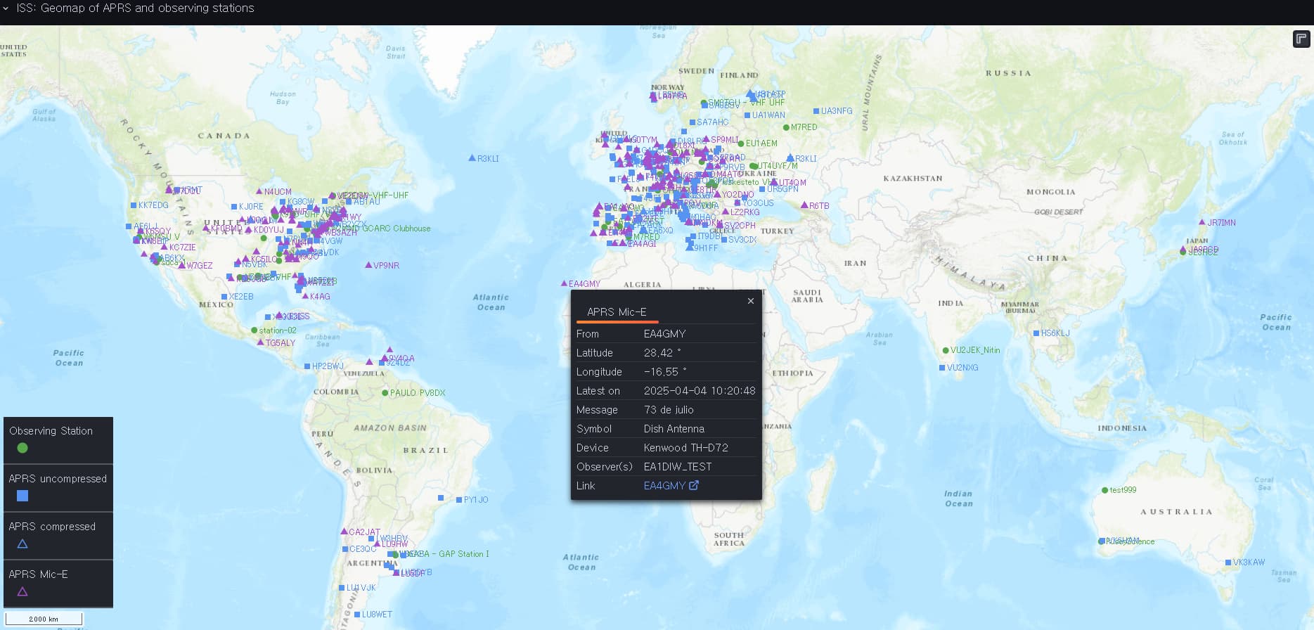
In the case of the ISS the Geomap is similar to APRS.ro SatMap and the static maps at ariss.net.
However, keep in mind that those websites get their data from APRS servers.
In contrast to that, the dashboards on SatNOGS are fed by uploads to the SatNOGS database (displayed by stations in green).
73
Daniel, dl7ndr