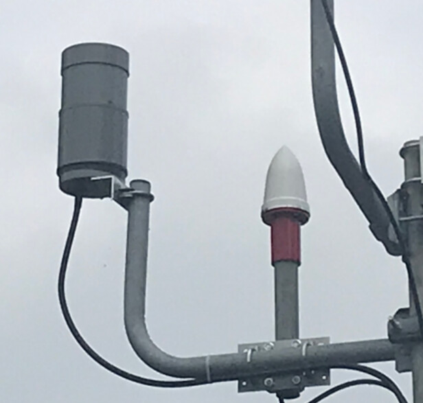
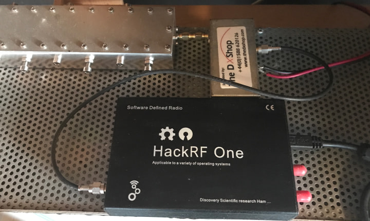
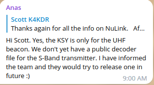
Not the reply that we would like to see ref. a KSY for the NuLink S-Band downlink, but I give them credit for answering the question.
2 Likes
Update on my previous post -
parker-research from the CalgaryToSpace team has confirmed these frames are not pre-launch ground tests, they are in-orbit frames received after the May 3 launch. The OBC real-time clock had not yet been synchronised, so it still displays the date it was last set before the satellite was integrated into the launch vehicle. The team is still working on establishing two-way contact to uplink a time correction.
So the “Frame 1: 2026-04-01 12:34:45 UTC” timestamps above are the OBC’s stale internal clock, not the actual receive time. The time_sync_source = eps_rtc and gnss_rx_mode = disabled values in the decoded fields are consistent with this — the clock hasn’t been GPS-synced yet.
Everything else in the decoded output (battery voltage, temperatures, uptime, beacon count) remains correct.
1 Like
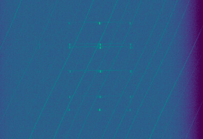
NuLink-2 observation https://network.satnogs.org/observations/14005735/ was EVER so close to having packets to decode, but I didn’t have any luck on replay. Just needed a bit more signal and a bit less noise.
7 Likes
I don’t know how long it will be before someone else puts up an S-Band satellite that transmits using a mode that we can decode, but I sure am glad I got to experience “normal” RX & decode on S-Band w/ these NuLink sats.
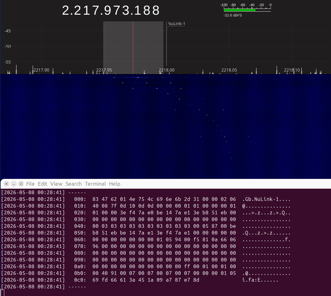
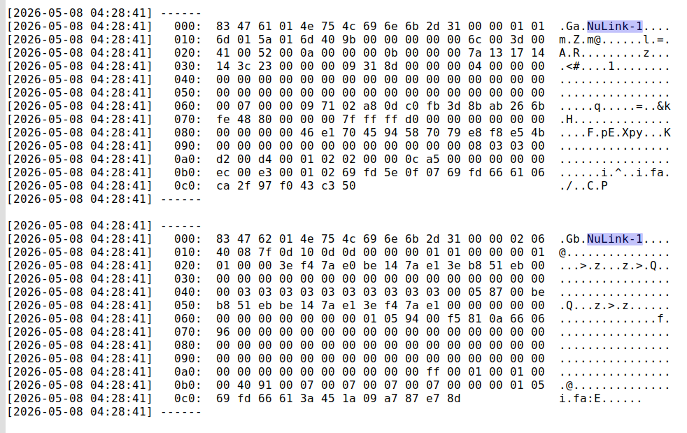
Tonight I went back to NuLink-1… only one packet strong enough to decode but each burst results in -2- frames:
1 Like
From space-track.org analyst list, we have for NuLink-1 a match with object 88063 and the TLE changed to use the temporary NORAD ID:
NULINK-1
1 98322U          26127.89154852 +.00002157 +00000+0 +21581-3 0  0012
2 98322  97.7386  26.1005 0003363 102.6521 257.5074 14.92465676 00068
1 Like
Observation https://network.satnogs.org/observations/14005791/ showed a different pattern of packets for NuLink-1… perhaps it was over the Team’s ground station.
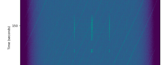
… I was hoping for more decodes but again, it’s all about SNR & you can judge for yourself by looking at the waterfall.
However, a few decodes came out - much shorter frames that I’ve been getting from the 30-second beacons over the U.S.

**Note: timestamps are the time of replay - not the time of the observation
1 Like
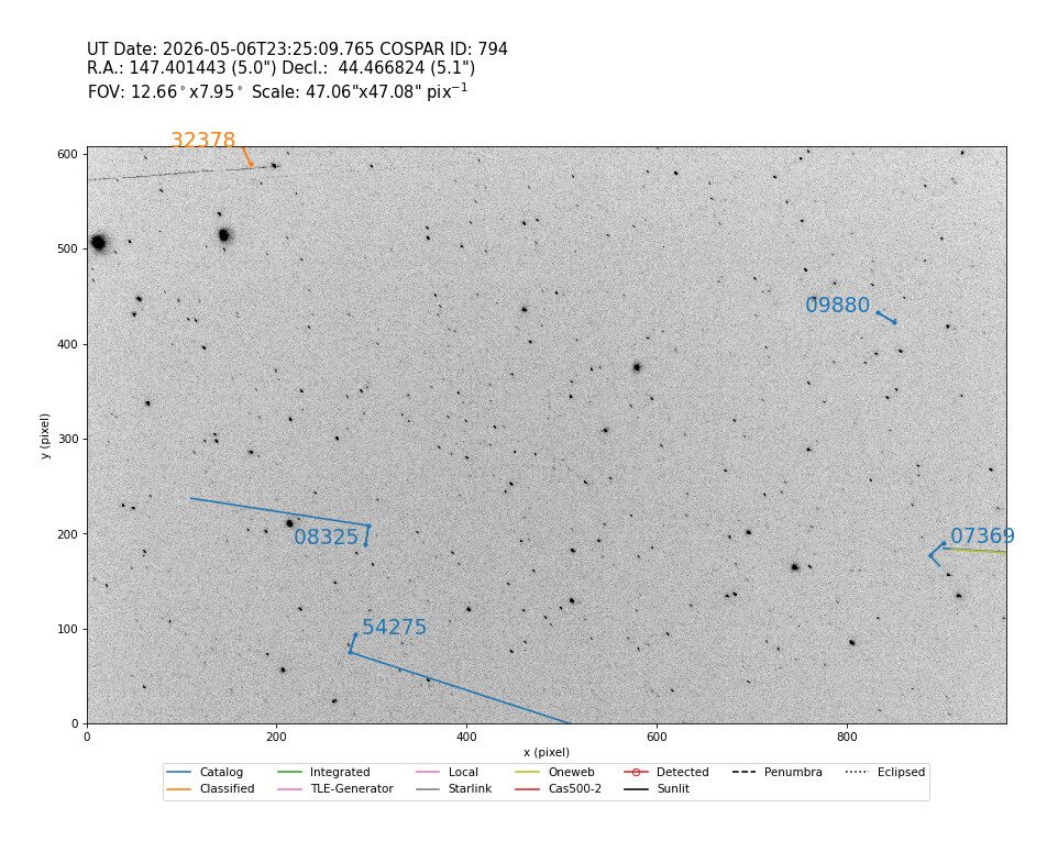
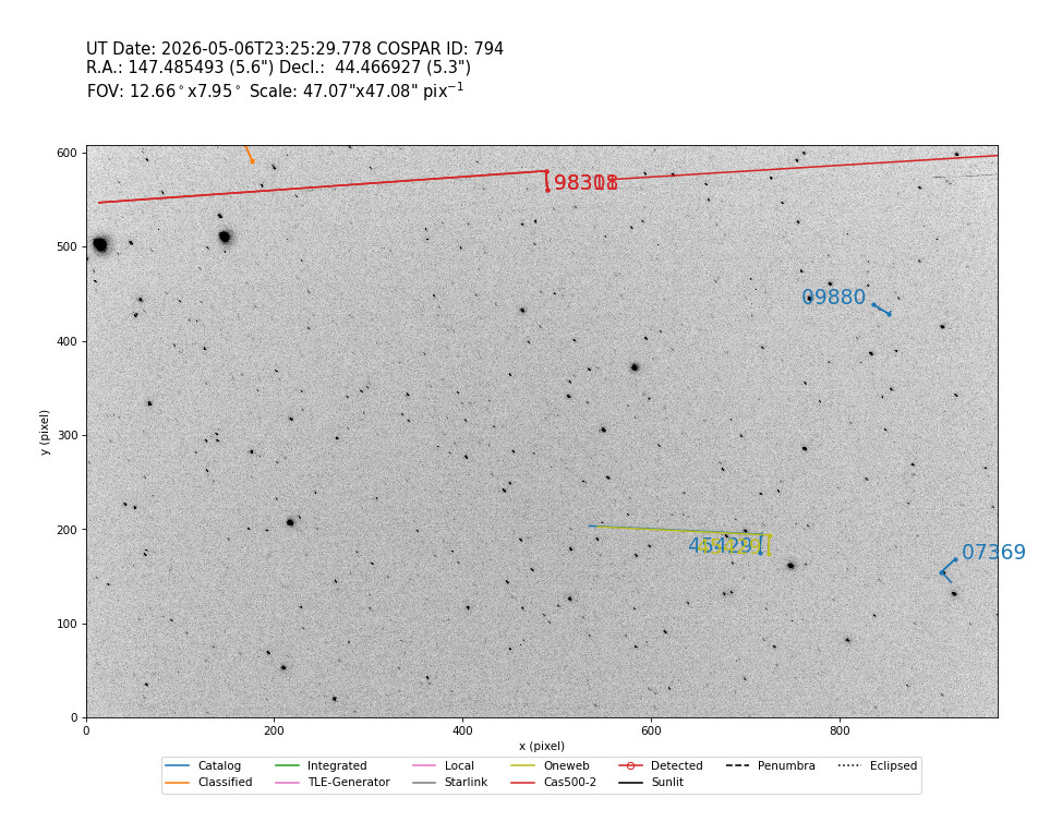
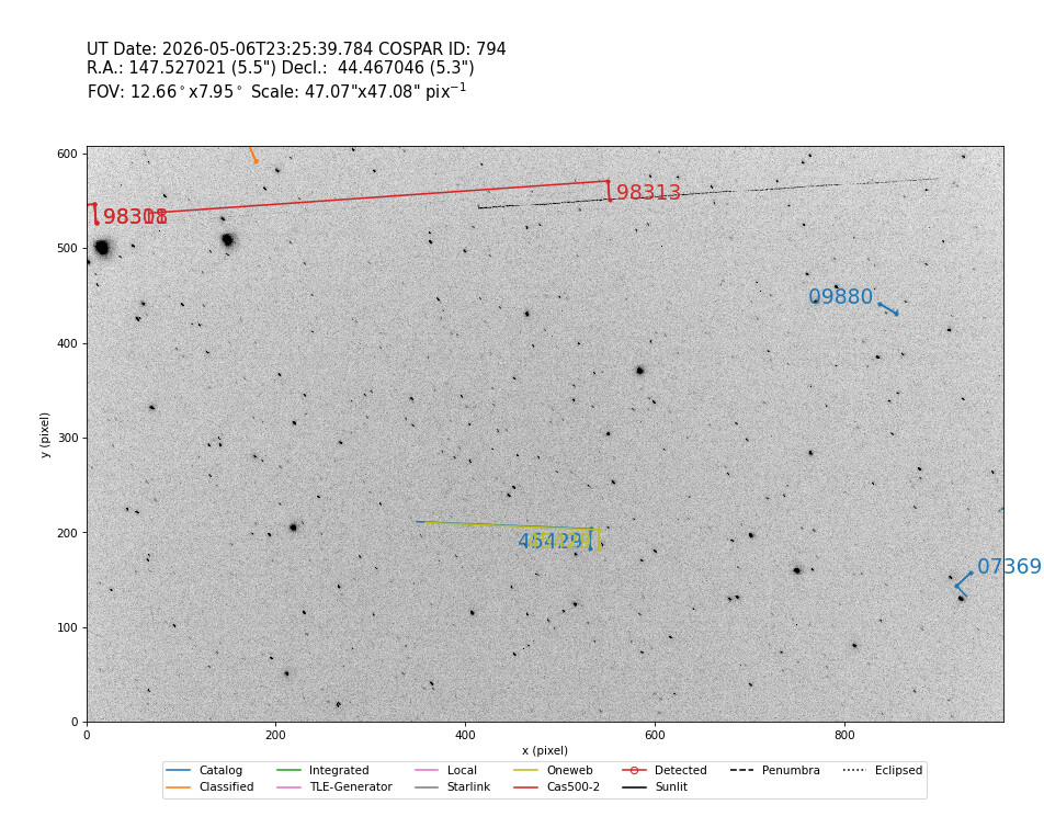
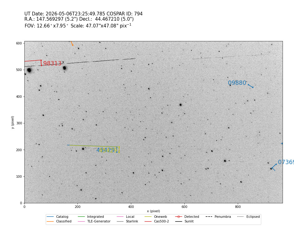
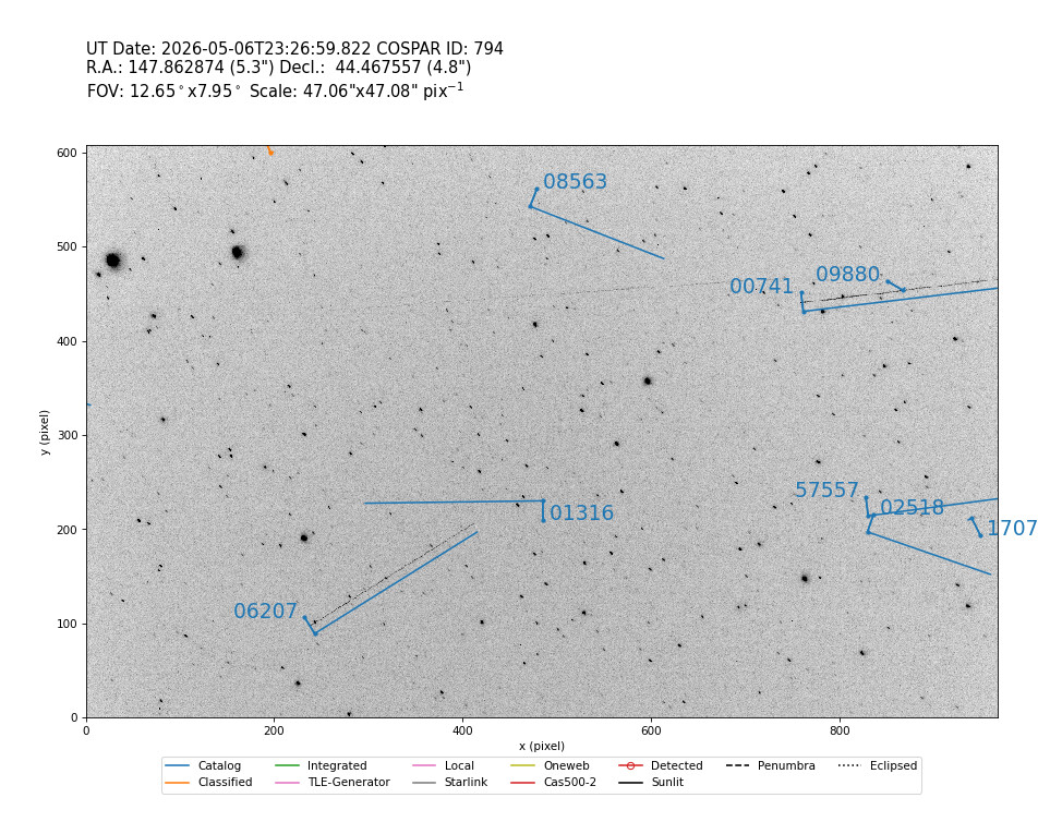
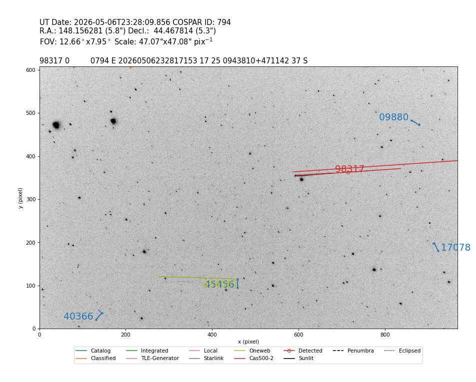
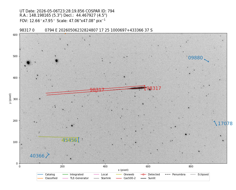
I happened to optically observe several satellites of this launch. I had listed all recent TLEs in this thread and added that as a TLE source to STVID. Such that the red L-Shaped overlays correspond to the TLEs found in this thread. The pictures have inverted black and white colors for better visibility. Here are the pictures.
It started with two faint ones in the top left:
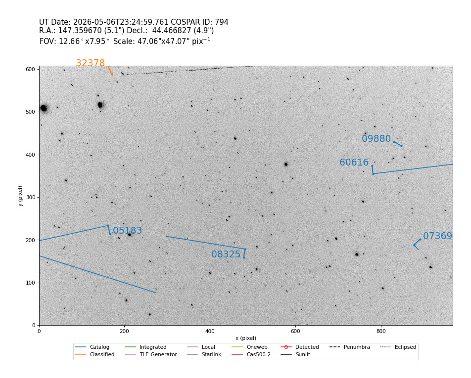
The TLE of BRO-21 98311 and HYDRA-3 98308 was close:
Also Drishiti 98313 TLE is close to a visible sat:
Followed by a few fainter ones:
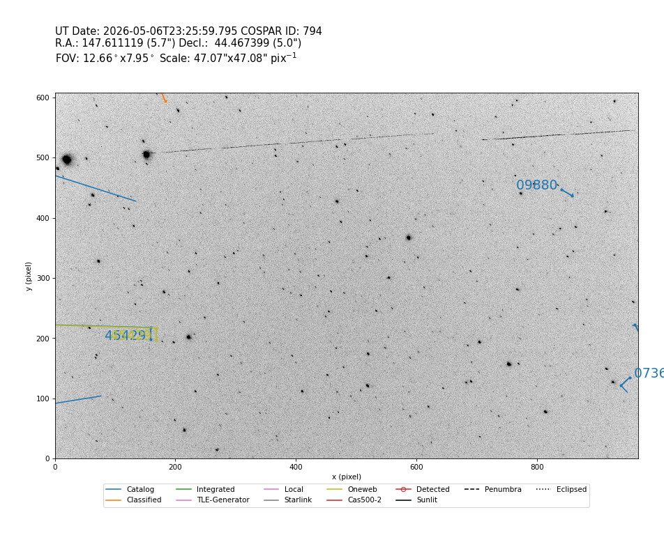
Next a bright satellite:
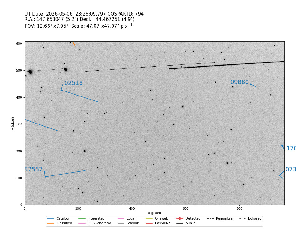

The bright one is being followed by a even brighter one:
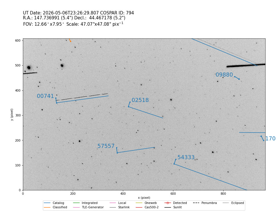
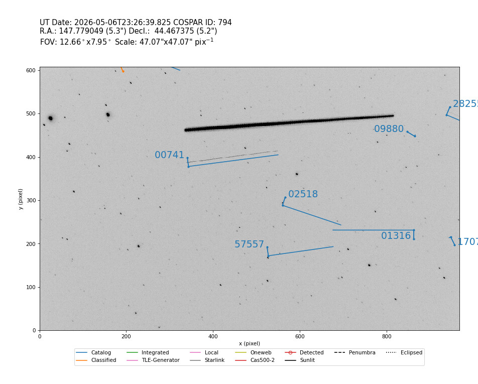
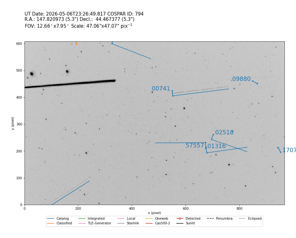
Then a very faint one:
Next two pictures show HELIOS 98317 giving a nice bright flash! Is it tumbling slowly?
Next two pictures show SELENE 98316 gave 4 bright flashes, and must be tumbling fast!!
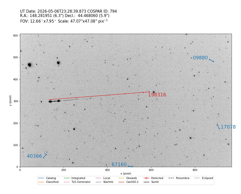
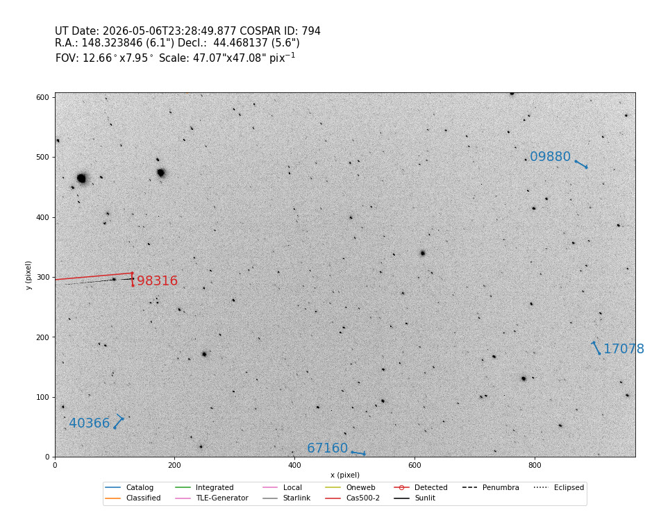
As the next one drift into view, this must be another (second) batch of satellites. All faint:
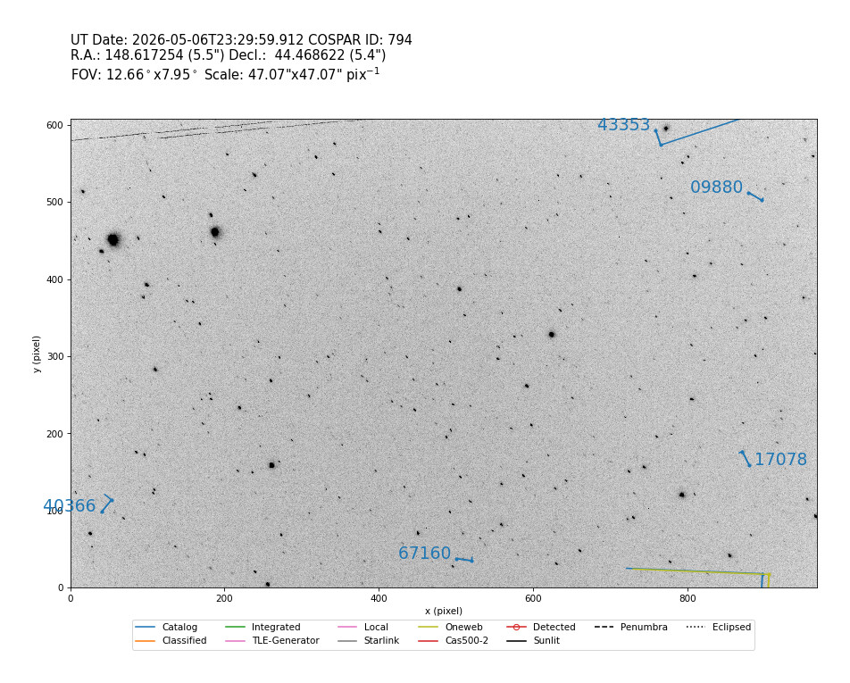
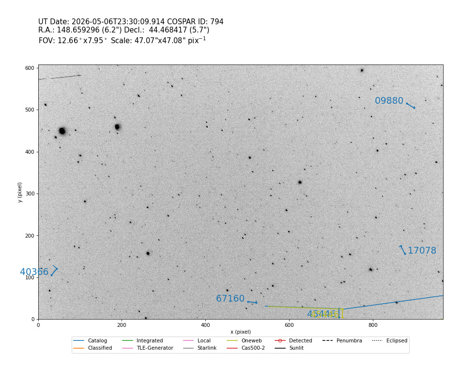
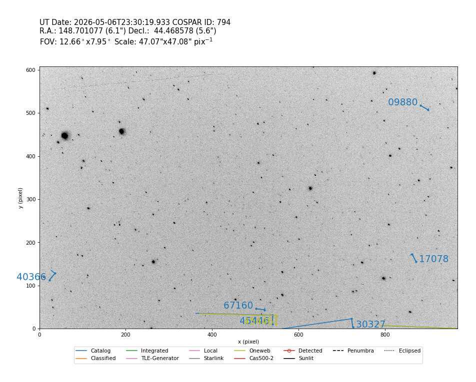
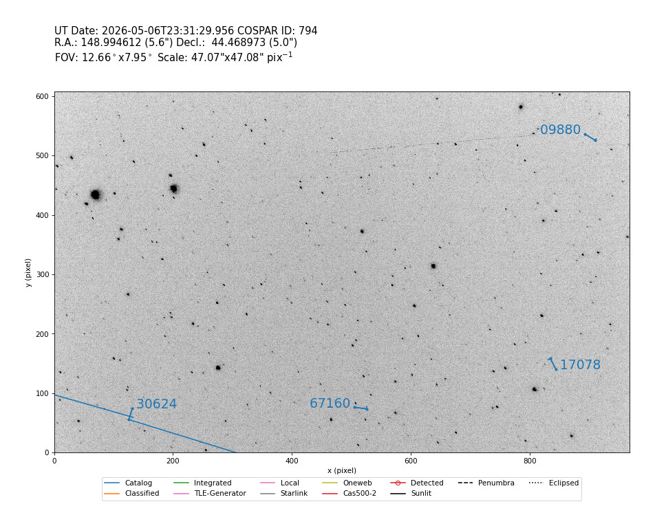
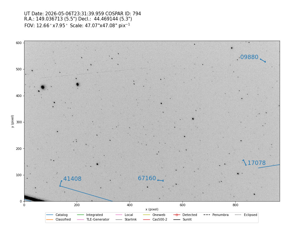
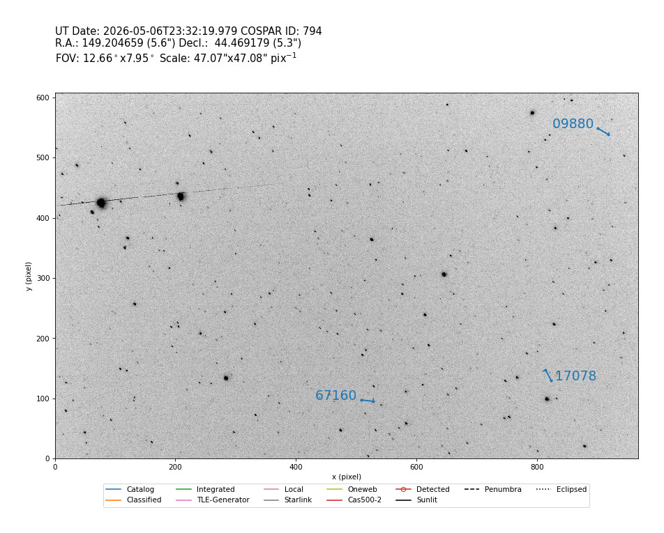
This shows that the optical observations can be a nice little extra besides the RF obs we are used to. It is possible to generate circular TLEs from these obs, that might be helpful in following them. Cheers!
8 Likes
interesting. seen like slow tumbling?
observation around that time (2026-05-06 23:35 UTC)
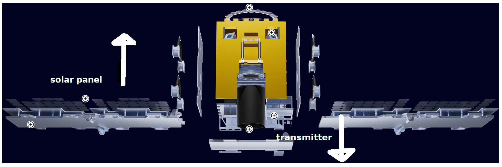
faint signal. maybe caused by solar panel that toward to earth (we see bright line), and transmitter to space (faint signal received by earth)
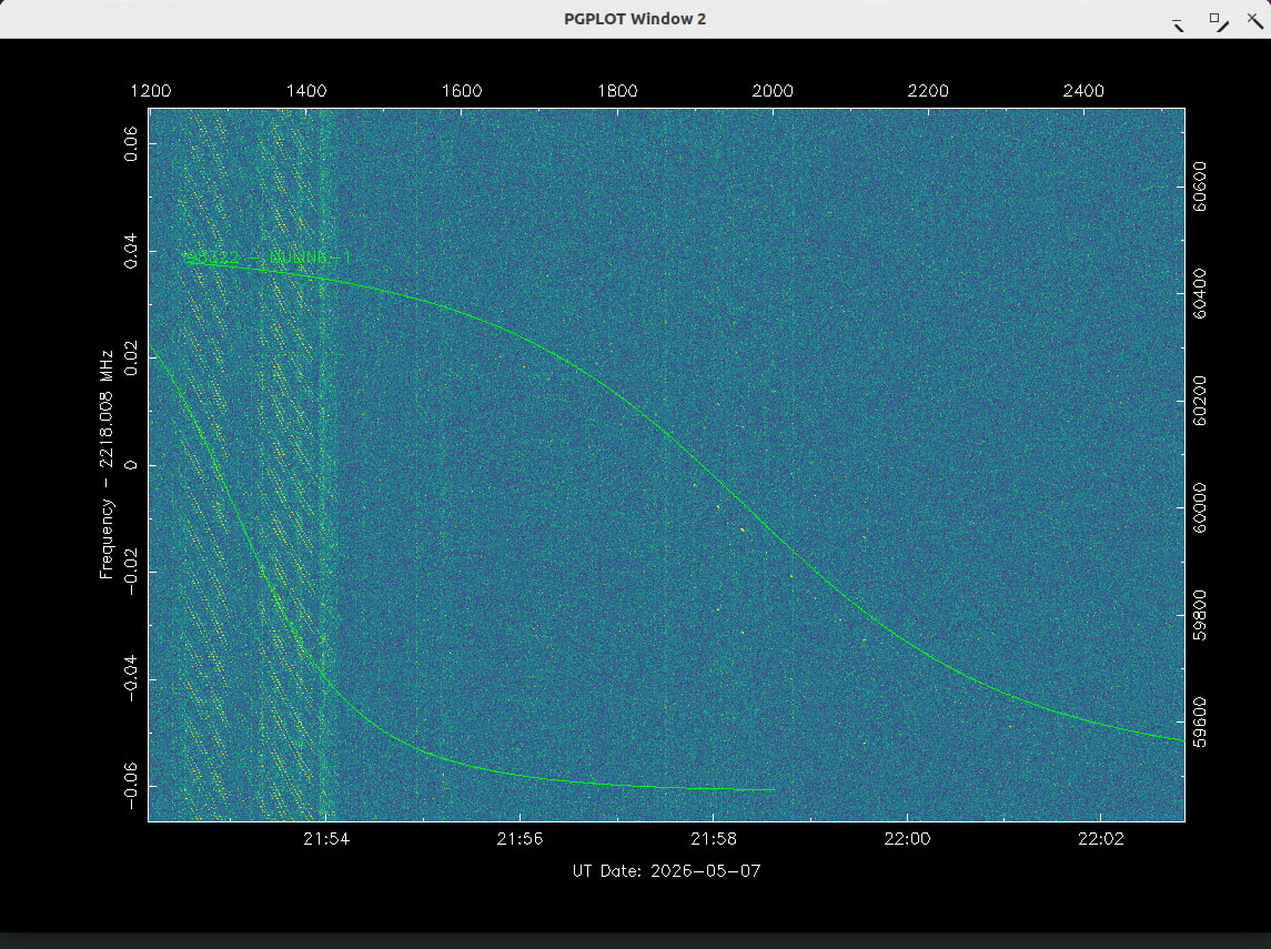
Here are the circular TLEs of the optical obs. Maybe we can use it to match the RF observation against and update the TLEs. I have skipped HELIOS 98317 and SELENE 98316 as these TLEs are good.
OBJ
1 90000U          26126.97579413  .00000000  00000-0  50000-4 0    03
2 90000  97.4477  25.4858 0001000   0.0000 125.3083 15.21862894    00
# 20260506.98-20260506.98, 12 measurements, 0.003 deg rms
OBJ
1 90000U          26126.97625238  .00000000  00000-0  50000-4 0    00
2 90000  97.4124  25.5325 0001000   0.0000 124.9960 15.21535369    02
# 20260506.98-20260506.98, 21 measurements, 0.004 deg rms
OBJ
1 90001U          26126.97642113  .00000000  00000-0  50000-4 0    02
2 90001  97.4165  25.5310 0001000   0.0000 124.9968 15.21361991    08
# 20260506.98-20260506.98, 20 measurements, 0.005 deg rms
OBJ
1 90001U          26126.97655519  .00000000  00000-0  50000-4 0    06
2 90001  97.4146  25.5288 0001000   0.0000 124.9847 15.21232555    00
# 20260506.98-20260506.98, 21 measurements, 0.004 deg rms
OBJ
1 90000U          26126.97663192  .00000000  00000-0  50000-4 0    01
2 90000  97.4180  25.5229 0001000   0.0000 124.9889 15.21476550    03
# 20260506.98-20260506.98, 21 measurements, 0.005 deg rms
OBJ
1 90000U          26126.97692902  .00000000  00000-0  50000-4 0    02
2 90000  97.4121  25.5386 0001000   0.0000 124.9703 15.21261119    00
# 20260506.98-20260506.98, 22 measurements, 0.004 deg rms
OBJ
1 90001U          26126.97710728  .00000000  00000-0  50000-4 0    00
2 90001  97.4061  25.5529 0001000   0.0000 124.7798 15.21336551    08
# 20260506.98-20260506.98, 13 measurements, 0.007 deg rms
OBJ
1 90001U          26126.97920267  .00000000  00000-0  50000-4 0    01
2 90001  97.8007  25.0982 0001000   0.0000 125.2918 14.90479849    03
# 20260506.98-20260506.98, 7 measurements, 0.003 deg rms
OBJ
1 90000U          26126.97925565  .00000000  00000-0  50000-4 0    06
2 90000  97.7721  25.1488 0001000   0.0000 125.2082 14.90744465    07
# 20260506.98-20260506.98, 10 measurements, 0.002 deg rms
OBJ
1 90000U          26126.97945138  .00000000  00000-0  50000-4 0    04
2 90000  97.7879  25.1187 0001000   0.0000 125.1364 14.90354402    07
# 20260506.98-20260506.98, 8 measurements, 0.007 deg rms
OBJ
1 90000U          26126.98032332  .00000000  00000-0  50000-4 0    08
2 90000  97.7586  25.1729 0001000   0.0000 124.7611 14.90033074    03
# 20260506.98-20260506.98, 19 measurements, 0.007 deg rms
OBJ
1 90000U          26126.98084557  .00000000  00000-0  50000-4 0    04
2 90000  97.7761  25.1419 0001000   0.0000 125.1821 14.89446374    01
# 20260506.98-20260506.98, 9 measurements, 0.004 deg rms
2 Likes
why only 90000 and 90001 ? how you create this? what software?

5 Likes
HELIOS and SELENE TLE updates from the satellite team using GPSS data, TLE changed to use DB’s temporary NORAD IDs:
HELIOS
1 98317U 26105HEL 26127.39272569  .00000000  00000-0  10661-2 0  9999
2 98317  97.4071  25.9386 0006384 120.6382 111.2451 15.19494150   626
SELENE
1 98316U 26105SEL 26126.12348032  .00000000  00000-0  10656-2 0  9991
2 98316  97.4069  24.6982 0005944 117.5122  14.9291 15.19388997   439
5 Likes
Update for Gemini-Pollux and FrontierSat from space-track.org latest analyst list. For Gemini-Pollux we have only one candidate 88061, and for FroniterSat again one candidate 88076. Here are the TLE sets changed to use temporary NORAD ID from DB:
Gemini-Pollux
1 98320U          26127.95974871 +.00001488 +00000+0 +15200-3 0 00127
2 98320  97.7359  26.1684 0002185  65.4430 294.7017 14.92081328000704
FrontierSat
1 98318U          26127.93831118 +.00006989 +00000+0 +31750-3 0 00116
2 98318  97.4034  26.4793 0008496 170.7052 189.4342 15.21049577000707
3 Likes
I don’t think so. I see this pattern on a lot of satellites and it’s an artifact of the camera.
The images where taken and processed with STVID. See GitHub - cbassa/stvid: Satellite tracking with video cameras · GitHub
It detects the streaks and matches it to TLEs, when possible. If nothing matches it measures it as a unknown starting from 90000 for the first sat in a picture. Second sat gets 90001, etc. The counting restarts at each picture. Therefore a lot of 90000 and 90001 measurements and tles. The measurements are not (yet) supported on Satnogs and are reported at the seesat emailing list. See EV Obs 2026-05-06/07 from E. Visser via Seesat-l on 2026-05-08 (SeeSat-L May-26)
The measurements are in IOD format. See IOD Observation Format Description
From these measurements you can make a TLE using the satfit of sattools. See sattools/src at main · cbassa/sattools · GitHub
This is the complete ecosystem of software for optical observations.
There is a low priority Satnogs Optical project, that uses this software and attempts to build a network of cameras.
1 Like
thank you for information. very interesting
that is cool
Updated TLE for SELENE, HELIOS, BRO-21, Drishti from space-track.org analyst list.
- For SELENE selected to follow 88081, other candidate 88070
- For HELIOS selected to follow 88082, other candidate 88083
- For BRO-21 selected to follow 88079
- For Drishti selected to follow 88071
TLE have been changed to use the temporary NORAD ID from DB:
SELENE
1 98316U          26127.94332418 +.00006429 +00000+0 +30680-3 0 00114
2 98316  97.4074  26.4828 0005958 112.2818 247.9049 15.19389534000698
HELIOS
1 98317U          26127.94302738 +.00005692 +00000+0 +27125-3 0 00141
2 98317  97.4059  26.4792 0006446 118.2731 241.9155 15.19485764000699
BRO-21
1 98311U          26127.93782498 +.00002927 +00000+0 +13428-3 0 00104
2 98311  97.4077  26.4902 0007630 182.3589 177.7612 15.21197021000700
Drishti
1 98313U          26127.94064685 +.00002277 +00000+0 +10809-3 0 00139
2 98313  97.4077  26.4846 0005910 152.2255 207.9297 15.20253038000697
3 Likes
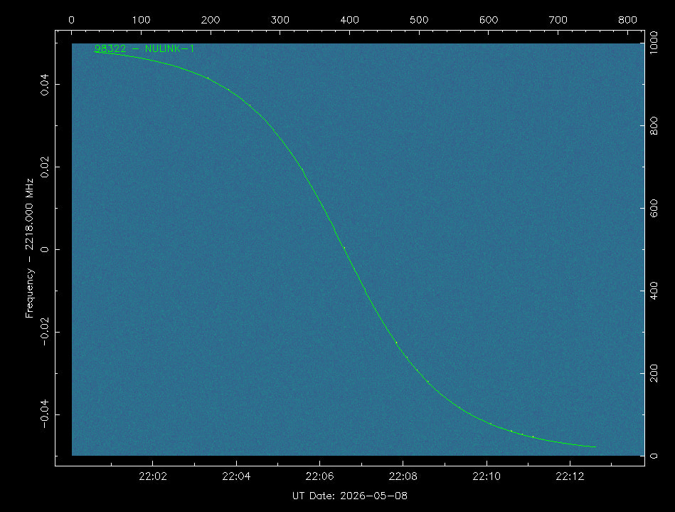
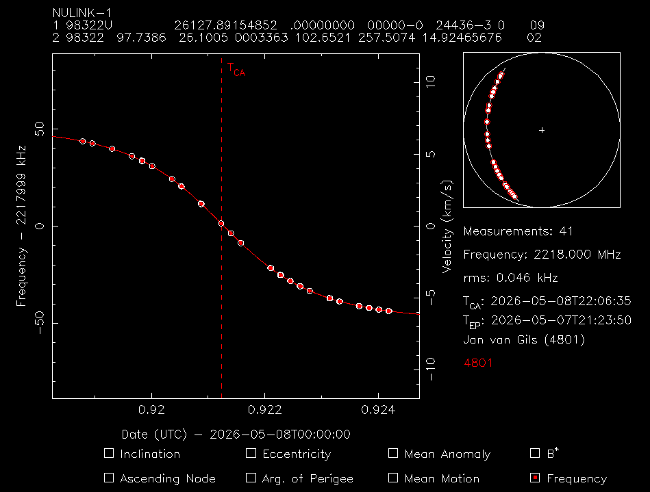
NULINK-1 TLE Update
NULINK-1
1 98322U          26127.89154852 +.00002157 +00000+0 +21581-3 0 00113
2 98322  97.7386  26.1005 0003363 102.6521 257.5074 14.92465676000686
Jan | PE0SAT
2 Likes
NULINK-2 TLE Update
NULINK-2
1 98321U          26129.50124135  .00001770  00000-0  17868-3 0  9992
2 98321  97.7363  27.6828 0002836  84.1931 275.9611 14.92317798   932
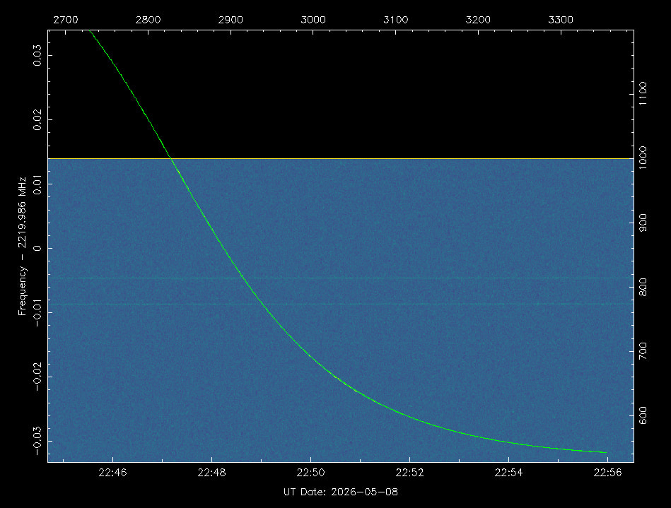
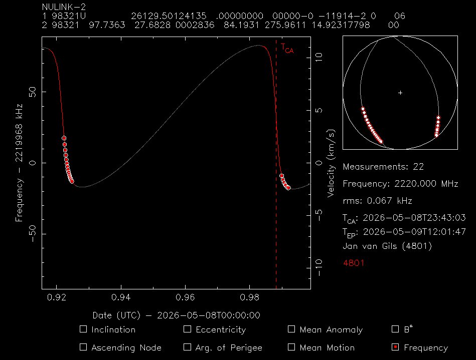
Because NULINK-2 2220 MHz is on the edge of my observation I can’t select the whole curve.
Jan | PE0SAT
2 Likes
Thanks so much! I’ve been updating every time someone posted a new TLE, these will be a great help!!
1 Like