Sure, it would be awesome to have imagery in NA as well if the team has time!
I was able to add a data fixing function that can fix a small amount of errors. As an example, here’s the original
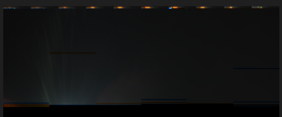
And then after processing
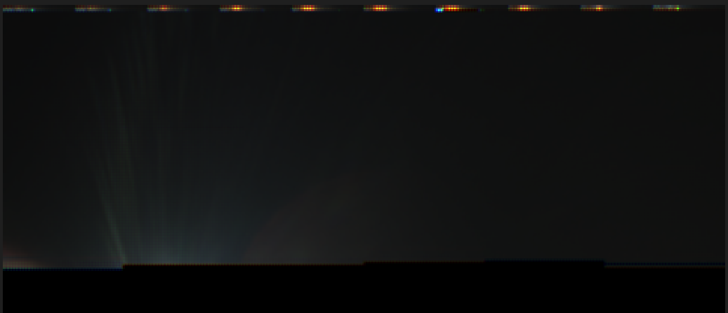
It’s not perfect as of now, and large amounts of errors can not be fixed occasionally.
2 Likes
Hopefully, the satellite will soon resume transmitting images of the Earth.
There was an image dump yesterday, if I’m not wrong
1 Like
@jupitersaturn09, it looks to me like you have two different parts of the same image in your posts above (top half in recent post, bottom half in earlier post). Maybe try to combine them? The team probably downlinked the same image twice several days apart.
1 Like
This is probably correct. I’ll have to find the files and assemble them. Thanks for spotting that!
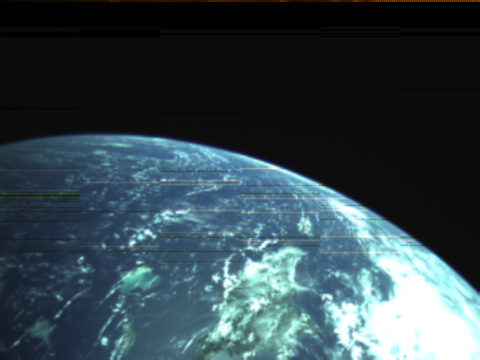
Latest imagery downlinked from RoseyCubesat-1 ![]()
2 Likes
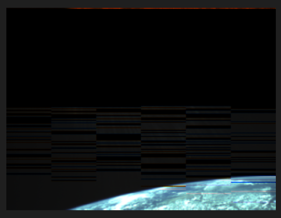
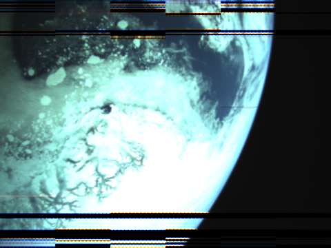
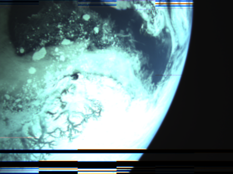
Wow @jupitersaturn09 , you beat the team to decoding that (they do not initially use satnogs data, and their own data was missing more of the image than this). This was taken over the North Pole. The team will attempt the same image download this evening to get the missing parts.
Very interesting image. Those bright patches look like floating ice, but the scale seems too large?
Alex
1 Like
Woah, awesome!!!
I’ll definitely look out for the upcoming pass, I’ll add it to the data already downlinked so we can have a full picture!
I don’t think too many cubesats have imaged the North Pole much, so this is definitely very new and much appreciated.
Not quite sure what the chunks are… possibly large floating pieces of ice? I think those have been detected before.
The North Pole is weird ![]()
2 Likes
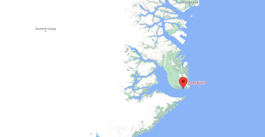
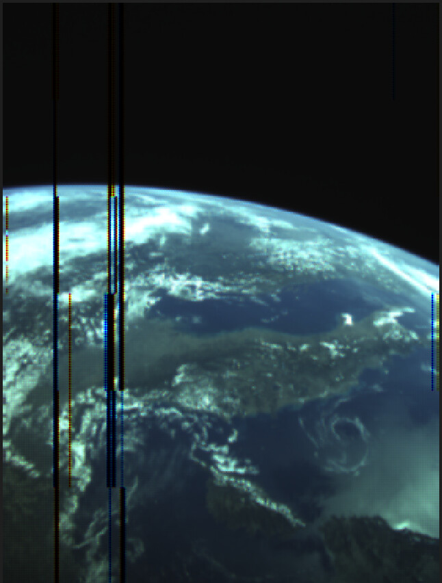
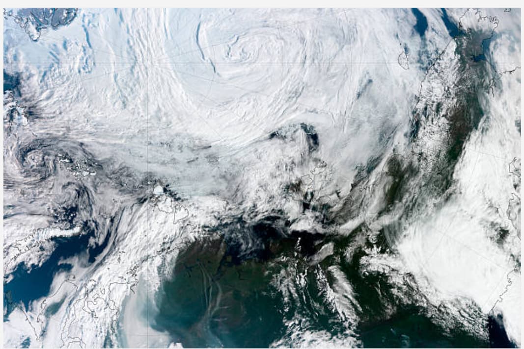
The target was in Greenland as shown in the map. I think they got it pretty spot on! It’s quite lucky as the 1U Cubesat has no attitude control, so it could be pointing in any direction when an image is taken (that’s also why the image appears upside down - the satellite was upside down!).
3 Likes
Fresh off the press
3 Likes
RoseyCubesat will attempt an image capture and download over Toronto today at approximately 11:24 Toronto local time. It is not confirmed that this is scheduled, but they are talking about giving it a go. Will give updates.
1 Like
This is both really really awesome and really sad at the same time for two reasons:
- I live in Toronto
- Today is the only day when I’m not available at 11:24.
I’ve notified a bunch of other VE3s in the area, so let’s see if any of them get anything.
Will there be other downloads over the area?
Thanks to the SATNOGs network, the download over Toronto resulted in an almost complete image, without any involvement of the official Groundstation! It hints at the ability to download a lot more data than would be possible through the official groundstation alone.
Thanks to @jupitersaturn09 for the rapid image reconstruction from SATNOGs data.
I have received news that the team will attempt a download over Brazil at 13:52 UTC tomorrow. I will give confirmation tomorrow morning if the command to schedule an image has been accepted by the satellite.
I cannot promise anything on behalf of the team, but If you would like to have an image taken and downloaded over your Groundstation, please comment here and I will try to pass on to the team.
4 Likes
UPDATE:
Confirmed that a download is planned over Boa Vista (Brazil) this friday (30/06/2023) at 12:34 UTC.
1 Like
Thank you so much @dial_tone for submitting an awesome PR with a bunch of command line options and readability improvements!
radio-satellites/RoseyCubesat-1-tools: Decode data from RoseyCubesat-1! (github.com)
1 Like
Unfortunately, it doesn’t look like any stations captured the image ![]()