HI,
If I see things right you are trying to match an TLE to a radio transmitter transponder output. Keep in mind that if the transmitting station is not using frequency correction matching the exact doppler curve the output you see in the modulated signal never can match the actual TLE>
Did you check the age of the TLE you are using ?
Nice to see another one jumping into the STRF tools by the way !
i’m just want ask satnogs admin to update the TLE. i use the STRF just for refit / update the current Lapan A2 TLE. so it will help make best observation for ground station
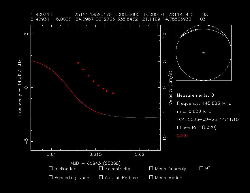
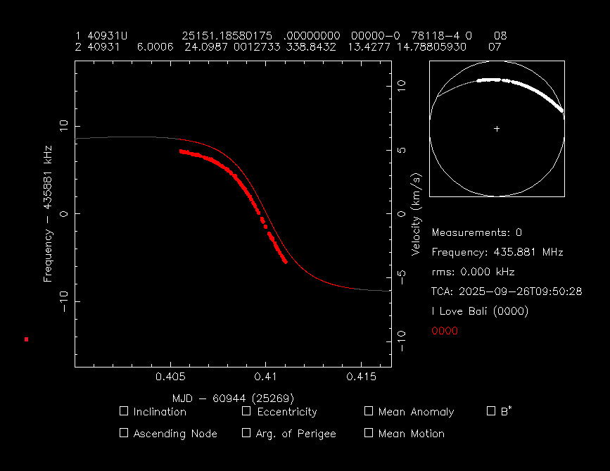
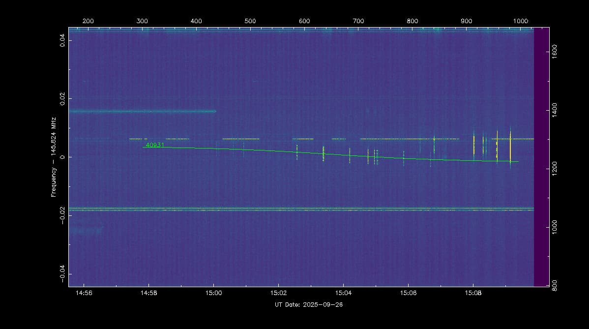
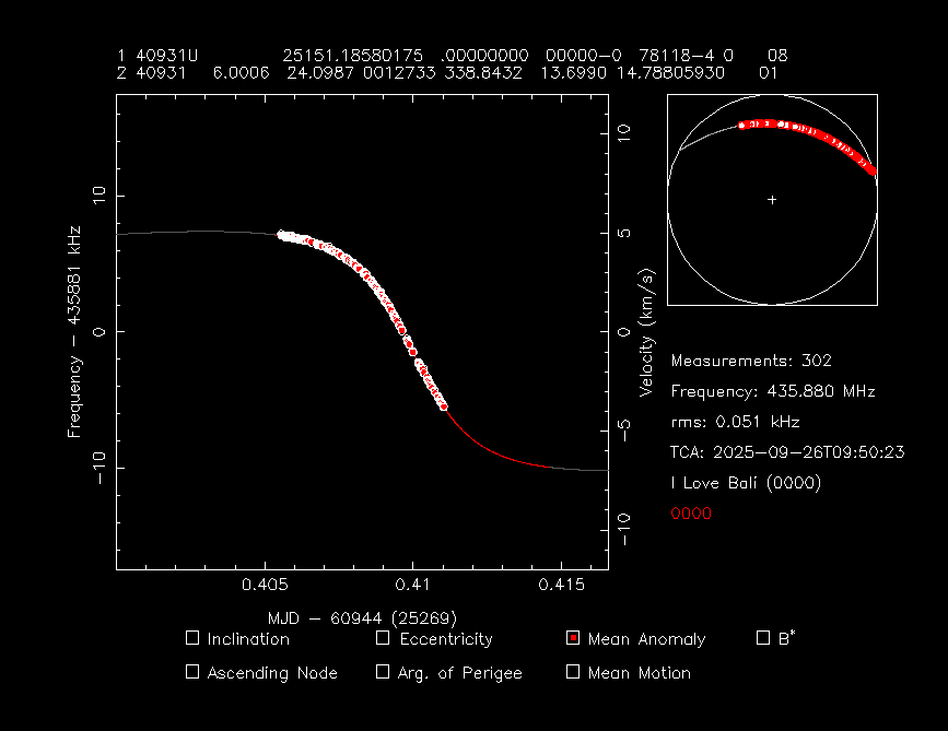
I can confirm LAPAN-A2 TLE data was way off (almost 2 minutes) and the TLE that was used is also more than a month older as the last update does not improve the accuracy.
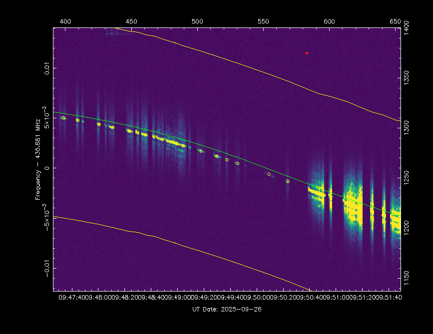
Here’s one of the observation, you can see the Doppler correction was really off
I echo your statement… We here in Brazil are delighted to have two active transponder passes over the weekend (one on Saturday and one on Sunday), and several operators have noticed a difference of about two minutes between the old TLE and the actual satellite position.
I have been providing an updated TLE to Brazilian operators every Friday so that we have an updated TLE before the satellite pass.
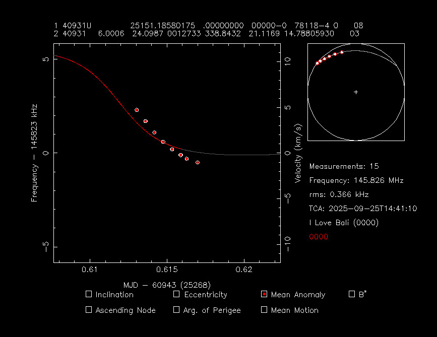
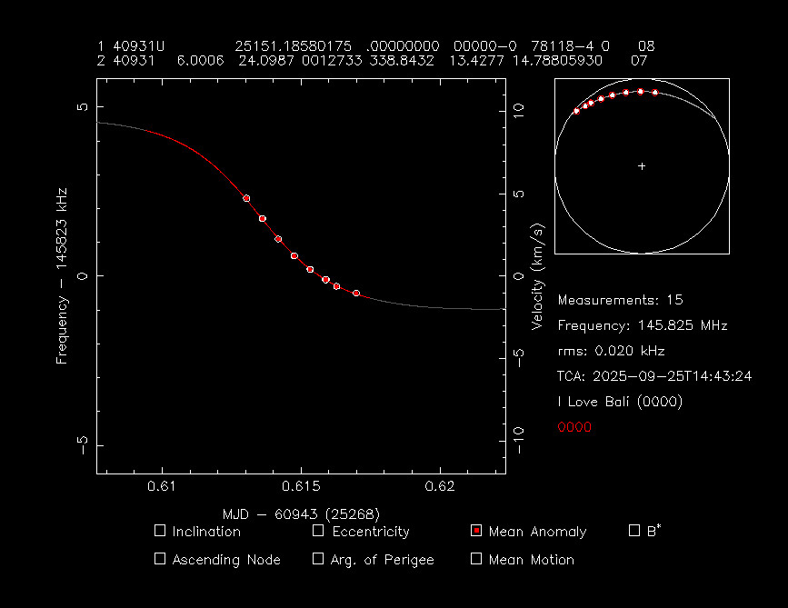
The TLE has been added, however it uses the epoch of the previous one so it will not be shown as the latest… let me see if I can fix this with using observations from the Network.
By the way it would be very helpful if you can also share the .dat file and the sites.txt files (or whatever are they named). This way we can verify and re-use these data.
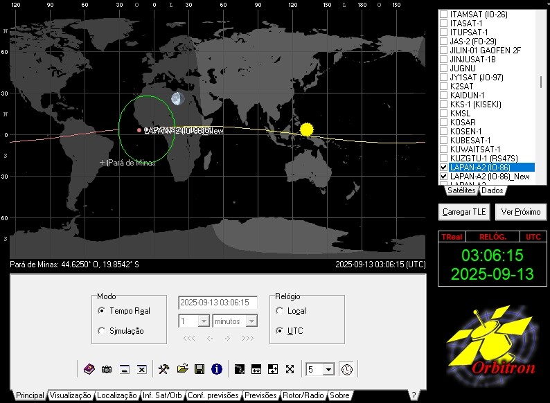
Where can I get hold of software which will display information as well as that displayed above? I run Linux on my main PC and Windows 11 on my laptops. I’m not a fan of Windows, but sometimes there is no other option. Thanks
Bob VK2BYF
Objects with low inclination are not very well tracked by space-track.org. For example Galassia-2, NuLIoN and VELOX-AM had similar issues. So, we can help these missions by generating TLE sets for them based on our observations.