GRBAlpha is close to its re-entry, I’ve opened this thread to track it and publish any updated TLE.
5 Likes
Recently I added this feature to the satellite onboard sw to emit AX.25 beacons like this:
GPS:1749072978,3599,69.85246,53.40131,256256.8
(see e.g. the 1st messege of this observation: SatNOGS Network - Observation 11706195)
The format is: UNIX timestamp, valid position counter (since the last reset), latitude, logintude and altitude. I will increase the cadence of these beacons to one minute soon ![]()
Just to add some additional source for TLE fitting if needed.
6 Likes
Uploaded GPS beacons will be shown on this Geomap panel of GRBAlpha’s dashboard.
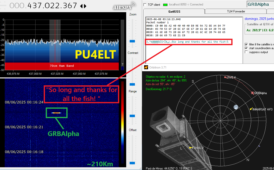
In the past at high altitudes, you needed huge power to use its digipeater. At these times, I had no luck. Now roughly at about 250 km, it’s working!
Why don’t give it a try?
Don’t use a via path, just send to an arbitrary destination.
The digipeater will repeat it “via OM9GRB-7”.
You may also use the DNxD ( Delayed Needronix Digipeater) repeating your sent message after x minutes.
Just put for example "@001 " in front of your message and the digipeater will repeat your message after 1 minute “via OM9GRB-8”.
Uploaded messages are displayed on the Digipeater Dashboard.
Good luck.
Daniel
4 Likes
Daniel, is there any way to fit a TLE to these GPS data? Are there any public software available for this purpose?
Never done this before but should be possible with a certain number of GPS data I guess.
And do you have these beacon collections in some simple textual format? One per line or something?
I took these 6 continuous GPS data points:
2025-06-05T10:44:05 - 2025-06-05T10:48:55
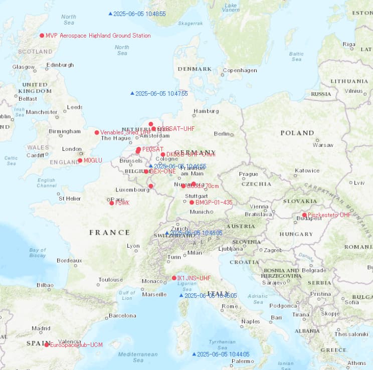
GRBAlpha’s Dashboard
2025-06-05 10:48:55|86A240404040E09E9A728EA4847F03F04750533A313734393132303533322C31393430302C35382E36313931322C322E35303636392C3235343234362E30
GPS:1749120532,19400,58.61912,2.50669,254246.0
2025-06-05 10:47:55|86A240404040E09E9A728EA4847F03F04750533A313734393132303437322C31393337302C35342E37313031392C342E34363637382C3235333637362E33
GPS:1749120472,19370,54.71019,4.46678,253676.3
2025-06-05 10:46:55|86A240404040E09E9A728EA4847F03F04750533A313734393132303431322C31393334302C35302E37373837312C362E31323539302C3235333036302E35
GPS:1749120412,19340,50.77871,6.12590,253060.5
2025-06-05 10:46:05|86A240404040E09E9A728EA4847F03F04750533A313734393132303335322C31393331302C34362E38333030312C372E35363636362C3235323430392E35
GPS:1749120352,19310,46.83001,7.56666,252409.5
2025-06-05 10:45:05|86A240404040E09E9A728EA4847F03F04750533A313734393132303239322C31393238302C34322E38363737322C382E38343436342C3235313736332E38
GPS:1749120292,19280,42.86772,8.84464,251763.8
2025-06-05 10:44:05|86A240404040E09E9A728EA4847F03F04750533A313734393132303233322C31393235302C33382E38393433372C392E39393839352C3235313132392E38
GPS:1749120232,19250,38.89437,9.99895,251129.8
4 Likes
5.06.2025 21.31UTC
4 Likes
@fredy pointed me to tle-estimate.
The described approach sounds promising, however returns error messages related to numpy on my system.
Good luck.
1 Like
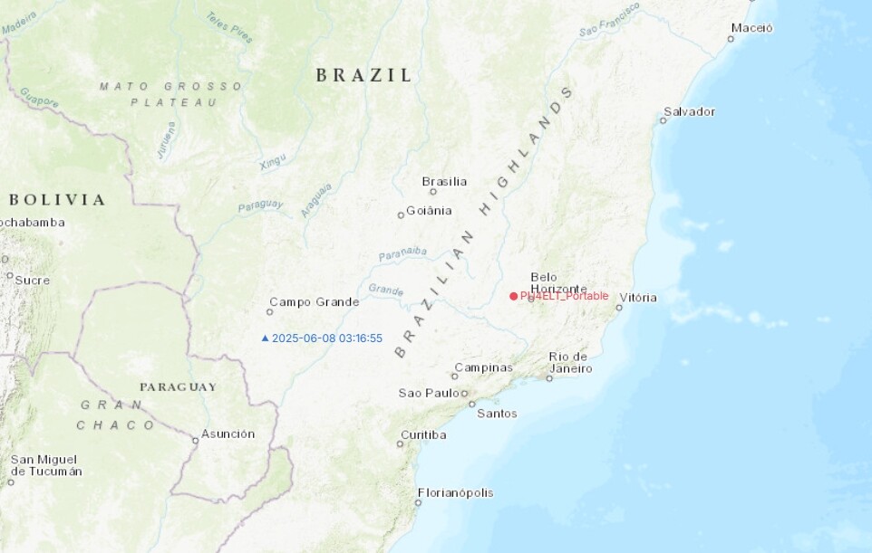
GRBAlpha over OI71oi, 04:09 UTC
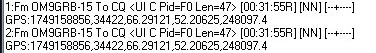
1:Fm OM9GRB To CQ [12:09:49R] [AA] [±-----]
,COMd,U,113042471,833733,R,346,V,333,Ve,2419,T,279,2949,Sig,2290,1632,1632,1620,1582,1587,RX,63302,8266164,Ax,3205,3696742,Digi,3205,1510371,CSP,59702,4569435,I2C1,19763169,107306,I2C2,106889,41483,RS485,421130,15212140,MCU,15237781,
1:Fm OM9GRB-15 To CQ [12:09:55R] [AA] [+++++++]
GPS:1749269392,69297,-12.32494,116.34257,236433.8
1:Fm OM9GRB To CQ [12:10:50R] [AA] [±+++±]
,COMd,U,113042531,833793,R,346,V,333,Ve,2425,T,279,2939,Sig,2290,1632,1632,2010,1982,1982,RX,63302,8266166,Ax,3205,3696744,Digi,3205,1510372,CSP,59702,4569435,I2C1,19763172,107306,I2C2,106889,41483,RS485,421130,15212143,MCU,15237784,
1:Fm OM9GRB-15 To CQ [12:10:55R] [AA] [+++++++]
GPS:1749269452,69327,-8.30089,115.55560,235665.3
2 Likes
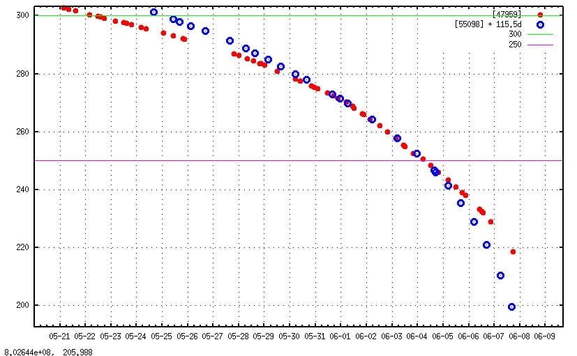
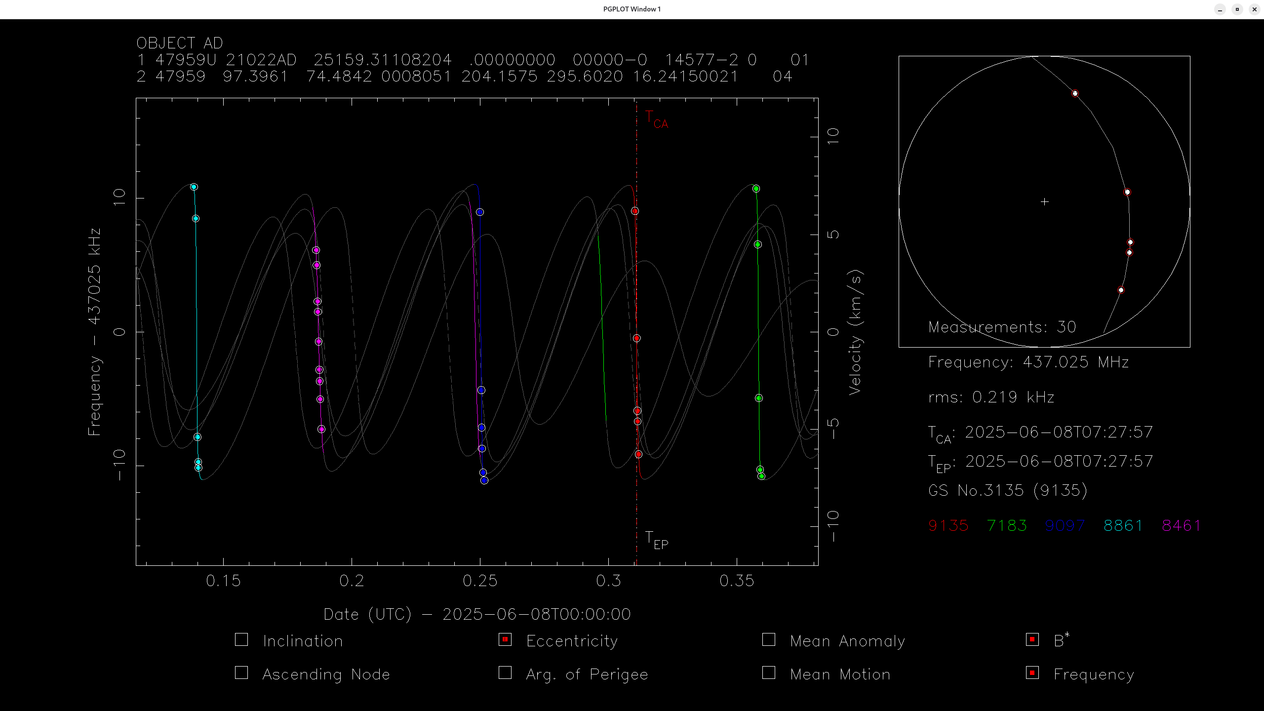
Some hours before its re-entry, here is an updated TLE based on the latest Network observations:
GRBAlpha
1 47959U 21022AD  25158.93882152  .00000000  00000-0  24586-2 0    00
2 47959  97.3969  73.8284 0009164 200.9592 285.6591 16.22202032    04
4 Likes
1 Like
Both satellites are the same size (1U cubesat) and mass (1.3 kg). Just the solar activity is now a bit lower… maybe…
Btw do you know which satellite was that where there were telemetry data just seconds before the actual reentry, i.e. where it was possible to see how quickly the temperature was just increasing before loss of signal? Afaik there was one, but i don’t remember which one… and if so, can we find those telemetry somewhere?
New TLE update:
GRBAlpha
1 47959U 21022AD  25159.31108204  .00000000  00000-0  14577-2 0    01
2 47959  97.3961  74.4842 0008051 204.1575 295.6020 16.24150021    04
grba_159_v4.dat (1.4 KB)
sites.txt (11.0 KB)
4 Likes
How is it matching with the GPS beacons? ![]()
Maybe Bobcat-1? Anyway you can check other re-entry threads. ![]()
Thanks ![]() I’m just curious how accurately/precisely can be the reentry be estimated, i.e. after we reach 200km, say, how much time (or orbits) do we have…
I’m just curious how accurately/precisely can be the reentry be estimated, i.e. after we reach 200km, say, how much time (or orbits) do we have…
No idea, unfortunately I didn’t have the time to create something to compare with gps data or even use them ![]() , I guess we can do an analysis after re-entry and check the accuracy of the generated TLE.
, I guess we can do an analysis after re-entry and check the accuracy of the generated TLE.
However have in mind that due to the nature of the signal (a flat line without any clear peaks) the produced TLE have an significant error. If CW was active we may had better results.
Yep, the good think about pure GMSK demodulators+decoders (i.e. I/Q => bitstream directly, without skipping the FM demod / audio layer) is that it can directly provide the freq offset, quite precisely… See e.g. mrc100_decode. Alpha is also GMSK but not demodulated/decoded this way…
1 Like