EIRSAT-1 is close to its re-entry, I’ve opened this thread to track it and publish any updated TLE.
6 Likes
EIRSAT-1 Flies about 1 min earlier from current TLE.
Manual Doppler correction.
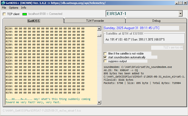
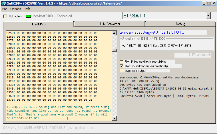
Message:
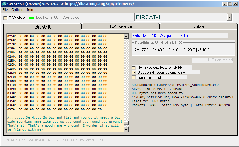
“So big and flat and round, it needs a big wide-sounding name like … ow … ound … round … ground! That’s it! That’s a good name — ground! I wonder if it will be friends with me?”
5 Likes
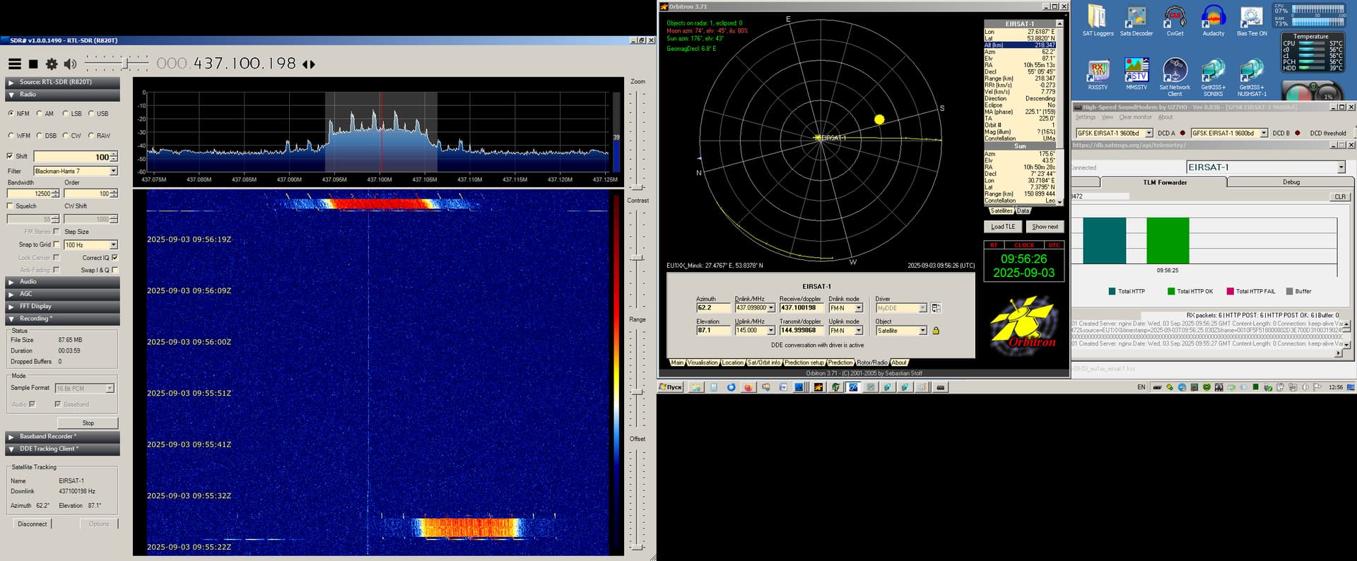
Indeed the TLE were off, but there was an update earlier today that seems to fit for now the singals. Let’s keep tracking!
2 Likes
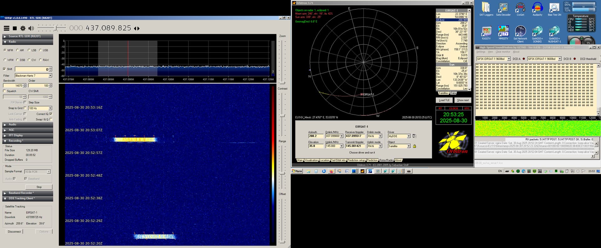
EIRSAT-1 Current TLE is Very GOOD !
Max. Elev. 14°.
Alt. ~260 km according TLE.
Decay prediction September 2 - 5.
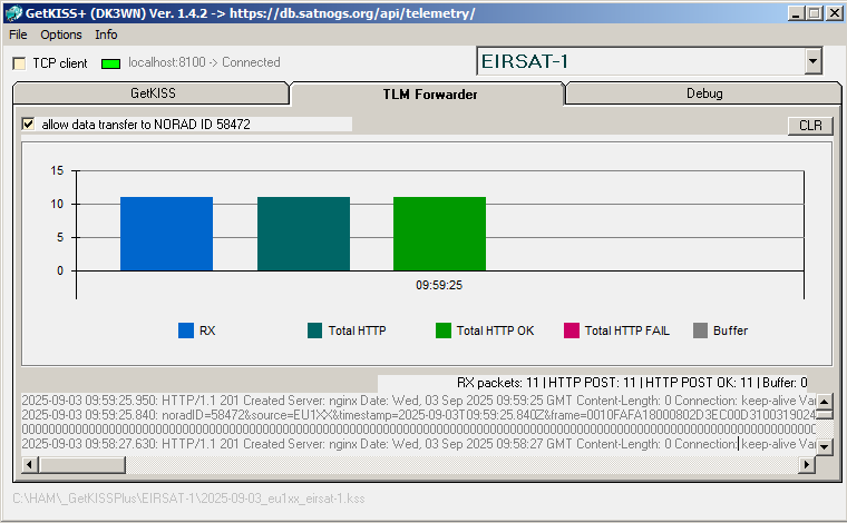
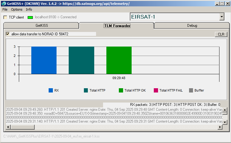
9 Frames uploaded
4 Likes
If anyone is wondering the quotes are from “The Hitchhiker’s Guide to the Galaxy”
Sure made me laugh!
Jomjom79
5 Likes
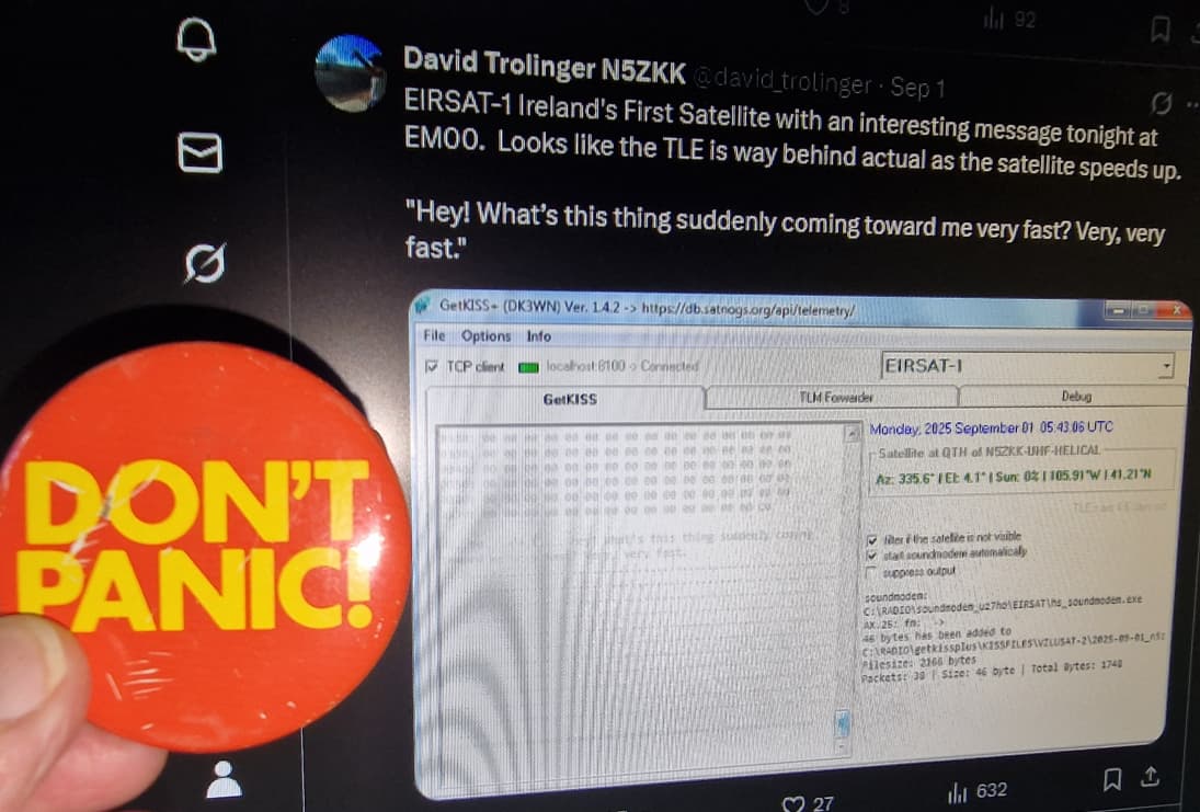
“Hello ground”
A fitting quote for a falling whale.., uh satellite ![]()
3 Likes
Updated TLE for EIRSAT-1:
EIRSAT-1
1 58472U 23185L   25245.93705369  .00000000  00000-0  14231-2 0    01
2 58472  97.3382 328.8819 0009892 260.7372 318.9586 16.20672374    02
2 Likes
4 Likes
Updated TLE:
EIRSAT-1
1 58472U 23185L   25246.21561336  .00000000  00000-0  88242-2 0    00
2 58472  97.3382 329.1263 0010443 260.7372 144.7471 16.24881994    05
eirsat_246_v1.dat (1.1 KB)
sites.txt (11.5 KB)
2 Likes
A fix on the TLE above:
EIRSAT-1
1 58472U 23185L   25246.34242269  .00000000  00000-0  19060-2 0    07
2 58472  97.3382 329.3305 0006609 260.7372 165.4615 16.24213308    01
sites.txt (11.5 KB)
eirsat_246_v3.dat (1.3 KB)
2 Likes
Updated TLE:
EIRSAT-1
1 58472U 23185L   25246.50938845  .00000000  00000-0  18985-2 0    02
2 58472  97.3382 329.5242 0008617 260.7372  61.8860 16.26562093    05
eirsat_246_v4.dat (945 Bytes)
sites.txt (11.5 KB)
3 Likes
One more TLE update:
EIRSAT-1
1 58472U 23185L   25246.72336155  .00000000  00000-0  23145-2 0    06
2 58472  97.3382 329.9505 0009474 173.2303 321.9269 16.29108049    08
sites.txt (11.5 KB)
eirsat_246_v6.dat (1.2 KB)
3 Likes
One more TLE update:
EIRSAT-1
1 58472U 23185L   25246.89496836  .00000000  00000-0  22706-2 0    09
2 58472  97.3382 330.0910 0009518 173.2303 248.0135 16.31767491    06
eirsat_246_v8.dat (1.5 KB)
sites.txt (11.5 KB)
1 Like
BEEGND-4 will upload the IQ data from its observation to our cloud if anyone wants to use them for STRF (remember they are already Doppler corrected) or for manual decoding of the data:
2 Likes
A small fix on the previous TLE, after the latest passes:
EIRSAT-1
1 58472U 23185L   25246.95503826  .00000000  00000-0  24348-2 0    08
2 58472  97.3382 330.2286 0008674 173.2303 240.4577 16.31932826    08
1 Like
TLE update from the latest passes:
EIRSAT-1
1 58472U 23185L   25247.13706707  .00000000  00000-0  23506-2 0    07
2 58472  97.3382 330.2928 0008674 173.2303 229.6554 16.36475905    00
sites.txt (11.5 KB)
eirsat_247_v1.dat (875 Bytes)
2 Likes
One more TLE based on latest network observations and the updated TLE (but already deprecated) from space-track.org:
EIRSAT-1
1 58472U 23185L   25247.33894048  .00000000  00000-0  12818-2 0    09
2 58472  97.3382 330.3260 0012125 173.2303 337.7266 16.38980223    03
eirsat_247_v2.dat (770 Bytes)
sites.txt (11.5 KB)
1 Like
One more TLE from the latest observations over Europe, maybe the last one:
EIRSAT-1
1 58472U 23185L   25247.45497331  .00000000  00000-0  12906-2 0    04
2 58472  97.3382 330.5008 0011389 173.2303 302.2478 16.42578069    04
sites.txt (11.5 KB)
eirsat_247_v3.dat (875 Bytes)
1 Like