PE0SAT
October 15, 2026, 2:14pm
1
Temporary NORAD ID
Satellite
Frequency
Mode
Notes
Deployment
UHF
98246 T.Microsat-3
401.025 MHz
GFSK 9600.0
-
Directly
98245 T.MicroSat-4
401.025 MHz
GFSK 9600.0
-
Directly
98187 FOSSASAT-2E27
401.700 MHz
LoRa 125000.0
-
Directly
NOT IN DB
-
Acadia 11
-
-
-
-
-
Acadia 12
-
-
-
-
-
Hawk 15A
-
-
-
-
-
Hawk 15B
-
-
-
-
-
Hawk 15C
-
-
-
-
-
FRG 100D4
-
-
-
-
-
GNOMES 11
-
-
-
-
-
ICEYE 1
-
-
-
-
-
ICEYE 2
-
-
-
-
-
ICEYE 3
-
-
-
-
-
ICEYE 4
-
-
-
-
-
LEO Express 4 (Mira)
-
-
-
-
-
Maxwell
-
-
-
-
-
Pelican 12
-
-
-
-
-
PTS 1
-
-
-
-
-
PTS 2
-
-
-
-
-
Pulsar 01
-
-
-
-
-
Pulsar 02
-
-
-
-
-
Pulsar 03
-
-
-
-
-
Pulsar 04
-
-
-
-
-
SIRIUS A
-
-
-
-
-
SIRIUS B
-
-
-
-
-
Starburst 1 (Motus Via Sol)
-
-
-
-
-
Tomorrow S14
-
-
-
-
-
Tomorrow S15
-
-
-
-
-
Umbra 13
-
-
-
-
-
Umbra 14
-
-
-
-
-
Tomorrow S15
-
-
-
-
-
Winnebago 7 (W-7)
-
-
-
-
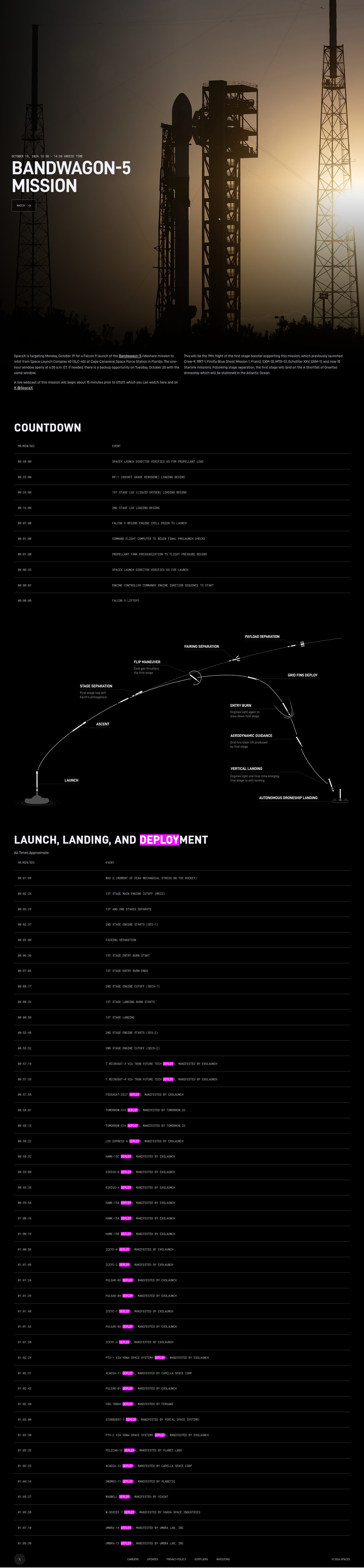
SpaceX Bandwagon-5 information Nasa Space Flight Bandwagon-5 information.
Orbit information, launch direction south east:
SpaceX’s Bandwagon-5 mission targets a mid-inclination Low Earth Orbit (LEO) at approximately a 45-degree inclination and an altitude of roughly 250 km (or 200–250 km initial insertion).
5 Likes
fredy
October 18, 2026, 9:01pm
3
Here are the supplemental TLE by celestrak.org :
TMICROSAT-3
1 72108C 26236A   26292.47729618 -.00001741  00000-0 -34105-3 0  9993
2 72108  52.9952 313.1710 0006518 272.7334  72.7401 14.91815381    19
TMICROSAT-4
1 72109C 26236B   26292.47749641 -.00001621  00000-0 -31757-3 0  9999
2 72109  52.9916 313.1712 0005856 275.4487  71.1081 14.91799214    18
FOSSASAT-2E27
1 72092C 26236C   26292.47775914  .00000117  00000-0  22924-4 0  9996
2 72092  52.9889 313.1707 0005235 275.3038  72.6709 14.91842324    18
TOMORROW-S15
1 72107C 26236D   26292.47778692  .00000336  00000-0  65568-4 0  9993
2 72107  52.9963 313.1687 0006347 266.0225  82.0879 14.91992776    15
TOMORROW-S14
1 72106C 26236E   26292.47795359  .00000425  00000-0  82949-4 0  9992
2 72106  52.9938 313.1686 0005914 270.1209  78.8904 14.91913141    13
IMPULSE-4 MIRA
1 72100C 26236F   26292.47803461  .00000218  00000-0  41176-4 0  9997
2 72100  52.9940 313.1682 0007571 220.5740 128.8718 14.93222784    13
HAWK-15C
1 72095C 26236G   26292.47814340 -.00001303  00000-0 -25201-3 0  9996
2 72095  52.9921 313.1682 0005570 252.5475  97.4868 14.92307949    15
SIRIUS-B
1 72105C 26236H   26292.47856933 -.00000569  00000-0 -10797-3 0  9999
2 72105  52.9916 313.1663 0006905 222.7526 129.5730 14.93079850    12
SIRIUS-A
1 72104C 26236J   26292.47892234 -.00000336  00000-0 -63722-4 0  9991
2 72104  52.9926 313.1646 0007177 223.2964 130.9252 14.93106441    19
HAWK-15A
1 72093C 26236K   26292.47910174 -.00000590  00000-0 -11199-3 0  9994
2 72093  52.9923 313.1638 0007008 224.5871 130.5997 14.93054298    12
HAWK-15B
1 72094C 26236L   26292.47939224 -.00000402  00000-0 -76384-4 0  9992
2 72094  52.9944 313.1624 0007257 227.4812 129.2633 14.93028303    14
ICEYE-X88
1 72097C 26236M   26292.47981933  .00000761  00000-0  14679-3 0  9993
2 72097  52.9936 313.1606 0005691 248.4492 110.5935 14.92401694    10
ICEYE-X110
1 72099C 26236N   26292.47996516  .00000952  00000-0  18093-3 0  9994
2 72099  52.9935 313.1599 0007073 228.3316 131.4951 14.92986357    14
PULSAR-02
1 72086C 26236P   26292.48013646  .00002092  00000-0  39806-3 0  9997
2 72086  52.9925 313.1592 0006868 228.3333 132.4164 14.92954866    19
PULSAR-04
1 72088C 26236Q   26292.48031586  .00002111  00000-0  40717-3 0  9997
2 72088  52.9926 313.1584 0005550 246.7035 115.0105 14.92423736    12
ICEYE-X109
1 72098C 26236R   26292.48041655  .00002902  00000-0  55245-3 0  9996
2 72098  52.9948 313.1580 0007107 231.2559 130.9953 14.92931979    13
PULSAR-03
1 72087C 26236S   26292.48047095  .00002222  00000-0  42833-3 0  9992
2 72087  52.9942 313.1578 0005846 246.7247 115.8199 14.92451767    11
ICEYE-X84
1 72096C 26236T   26292.48052766  .00001280  00000-0  24621-3 0  9991
2 72096  52.9909 313.1573 0005465 241.2239 121.6325 14.92518306    16
PTS-1
1 72114C 26236U   26292.48089340  .00000175  00000-0  33665-4 0  9991
2 72114  52.9943 313.1560 0005895 245.3742 119.4417 14.92486049    17
CAPELLA-21 (ACADIA)
1 72089C 26236V   26292.48091076  .00002227  00000-0  42421-3 0  9990
2 72089  52.9920 313.1557 0006743 229.2840 135.6300 14.92914340    13
PULSAR-01
1 72085C 26236W   26292.48105313  .00002720  00000-0  51846-3 0  9995
2 72085  52.9949 313.1554 0007025 233.1047 132.5687 14.92884564    12
FRG-100D4
1 72091C 26236X   26292.48110868  .00001745  00000-0  33284-3 0  9995
2 72091  52.9913 313.1547 0006482 230.2815 135.6981 14.92854252    11
STARBURST-1
1 72103C 26236Y   26292.48125336  .00001266  00000-0  24343-3 0  9999
2 72103  52.9946 313.1545 0006028 243.7410 123.0096 14.92535213    16
PTS-2
1 72115C 26236Z   26292.48159363  .00000713  00000-0  13613-3 0  9993
2 72115  52.9951 313.1532 0006893 235.1453 133.4338 14.92827285    10
PELICAN-12 3013
1 72102C 26236AA  26292.48163183  .00000892  00000-0  17039-3 0  9998
2 72102  52.9916 313.1523 0006399 232.1803 136.6114 14.92804327    13
CAPELLA-22 (ACADIA)
1 72090C 26236AB  26292.48165035  .00002707  00000-0  51986-3 0  9998
2 72090  52.9912 313.1522 0005682 238.0447 130.8477 14.92592765    15
GNOMES-11
1 72101C 26236AC  26292.48210405  .00003394  00000-0  65136-3 0  9998
2 72101  52.9955 313.1511 0006344 241.8104 129.5120 14.92621003    19
MAXWELL
1 72113C 26236AD  26292.48306354  .00002635  00000-0  50634-3 0  9994
2 72113  52.9949 313.1469 0006063 242.5678 133.9149 14.92572159    16
W-SERIES 7
1 72112C 26236AE  26292.48330544  .00002503  00000-0  47849-3 0  9999
2 72112  52.9951 313.1460 0006759 237.4308 140.3519 14.92774623    17
UMBRA-14
1 72111C 26236AF  26292.48413993  .00003251  00000-0  62345-3 0  9997
2 72111  52.9955 313.1427 0006374 241.3882 140.8800 14.92649994    17
UMBRA-13
1 72110C 26236AG  26292.48575799  .00004571  00000-0  87429-3 0  9995
2 72110  52.9913 313.1330 0006358 233.0597 157.9194 14.92751833    17
And here are the TLE from the above list for the 3 satellites that are in DB, changed to use the temporary NORAD ID:
TMICROSAT-3
1 98246C 26236A   26292.47729618 -.00001741  00000-0 -34105-3 0  9994
2 98246  52.9952 313.1710 0006518 272.7334  72.7401 14.91815381    10
TMICROSAT-4
1 98245C 26236B   26292.47749641 -.00001621  00000-0 -31757-3 0  9998
2 98245  52.9916 313.1712 0005856 275.4487  71.1081 14.91799214    17
FOSSASAT-2E27
1 98187C 26236C   26292.47775914  .00000117  00000-0  22924-4 0  9999
2 98187  52.9889 313.1707 0005235 275.3038  72.6709 14.91842324    11
5 Likes
fredy
October 19, 2026, 10:03am
4
Launch date changed for tomorrow, 2026-10-20 10:30 UTC.
TLE will be updated later today.
6 Likes
Hello everyone,
We are from Tron Future Tech Inc., Taiwan, the team behind the T.MicroSat series.
Following the launches of T.MicroSat-1 and T.MicroSat-2, our next two satellites, T.MicroSat-3 and T.MicroSat-4 , are scheduled to launch aboard SpaceX’s Bandwagon-5 mission.
We would like to kindly ask for the community’s assistance in monitoring the UHF beacon signals from both satellites after deployment, particularly during the early stages of LEOP.
Below are some details that may be helpful for identifying our beacon signals:
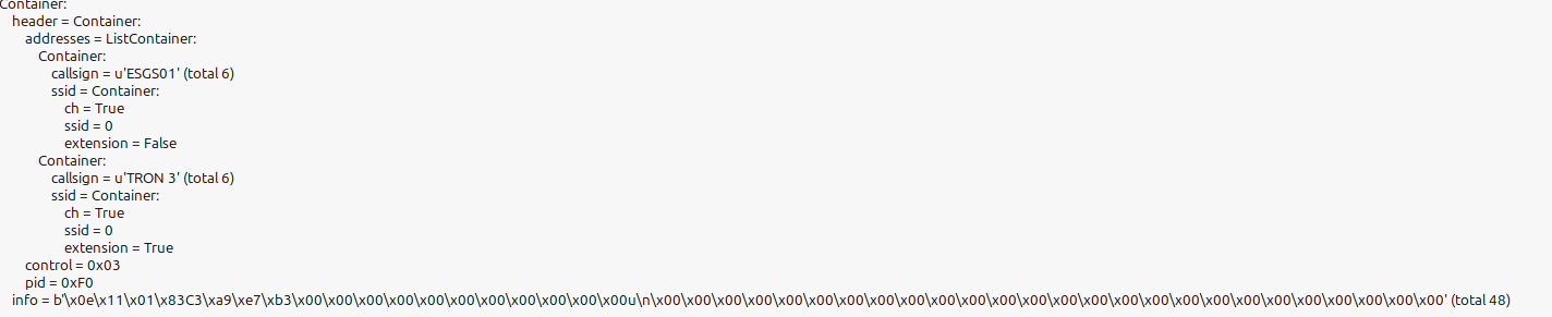
Frequency: 401.025 MHzModulation: GFSKBaud: 9600AX.25 source addresses:
T.MicroSat-3: TRON 3
T.MicroSat-4: TRON 4
AX.25 destination address: ESGS01
Any reception reports, decoded beacon frames, or other observations would be greatly appreciated and would be very helpful to our team in confirming the satellites’ initial communication status.
Special thanks to @fredy for sharing the pre-launch TLE data. We sincerely appreciate the community’s support and look forward to any observations you may be able to share.
Best regards,
3 Likes
K4KDR
October 20, 2026, 2:22am
6
We’ll be listening - best of luck!
1 Like
fredy
October 20, 2026, 5:13am
7
Supplemental TLE sets by celestrak.org for the updated launch datetime 2026-10-20 10:30 UTC
TMICROSAT-3
1 72108C 26237A   26293.47729618 -.00001538  00000-0 -30116-3 0  9997
2 72108  52.9952 314.1566 0006519 272.7321  72.7414 14.91815383    12
TMICROSAT-4
1 72109C 26237B   26293.47749641 -.00001418  00000-0 -27774-3 0  9999
2 72109  52.9916 314.1569 0005856 275.4471  71.1098 14.91799219    15
FOSSASAT-2E27
1 72092C 26237C   26293.47775914  .00000711  00000-0  13919-3 0  9991
2 72092  52.9889 314.1564 0005235 275.3011  72.6735 14.91842323    19
TOMORROW-S15
1 72107C 26237D   26293.47778692  .00000978  00000-0  19062-3 0  9994
2 72107  52.9963 314.1543 0006347 266.0203  82.0901 14.91992774    17
TOMORROW-S14
1 72106C 26237E   26293.47795359  .00001063  00000-0  20776-3 0  9992
2 72106  52.9937 314.1543 0005914 270.1184  78.8928 14.91913141    13
IMPULSE-4 MIRA
1 72100C 26237F   26293.47803461  .00000765  00000-0  14448-3 0  9997
2 72100  52.9940 314.1538 0007571 220.5732 128.8725 14.93222787    16
HAWK-15C
1 72095C 26237G   26293.47814340 -.00001133  00000-0 -21915-3 0  9997
2 72095  52.9921 314.1538 0005570 252.5467  97.4877 14.92307963    13
SIRIUS-B
1 72105C 26237H   26293.47856933 -.00000303  00000-0 -57461-4 0  9997
2 72105  52.9916 314.1520 0006905 222.7528 129.5728 14.93079868    13
SIRIUS-A
1 72104C 26237J   26293.47892234 -.00000070  00000-0 -13208-4 0  9992
2 72104  52.9926 314.1502 0007177 223.2964 130.9252 14.93106464    16
HAWK-15A
1 72093C 26237K   26293.47910174 -.00000416  00000-0 -78897-4 0  9992
2 72093  52.9923 314.1495 0007008 224.5874 130.5994 14.93054326    16
HAWK-15B
1 72094C 26237L   26293.47939224 -.00000228  00000-0 -43295-4 0  9995
2 72094  52.9944 314.1480 0007258 227.4812 129.2633 14.93028334    10
ICEYE-X88
1 72097C 26237M   26293.47981933  .00001165  00000-0  22475-3 0  9997
2 72097  52.9936 314.1462 0005691 248.4467 110.5960 14.92401726    17
ICEYE-X110
1 72099C 26237N   26293.47996516  .00001365  00000-0  25950-3 0  9995
2 72099  52.9935 314.1456 0007073 228.3302 131.4964 14.92986389    11
PULSAR-02
1 72086C 26237P   26293.48013646  .00002759  00000-0  52497-3 0  9990
2 72086  52.9925 314.1448 0006868 228.3307 132.4189 14.92954895    10
PULSAR-04
1 72088C 26237Q   26293.48031586  .00002764  00000-0  53310-3 0  9996
2 72088  52.9926 314.1440 0005550 246.6997 115.0143 14.92423767    16
ICEYE-X109
1 72098C 26237R   26293.48041655  .00003723  00000-0  70881-3 0  9993
2 72098  52.9948 314.1437 0007107 231.2526 130.9986 14.92932007    18
PULSAR-03
1 72087C 26237S   26293.48047095  .00002876  00000-0  55433-3 0  9999
2 72087  52.9942 314.1434 0005846 246.7210 115.8236 14.92451800    13
ICEYE-X84
1 72096C 26237T   26293.48052766  .00001685  00000-0  32415-3 0  9992
2 72096  52.9909 314.1430 0005465 241.2212 121.6352 14.92518346    14
PTS-1
1 72114C 26237U   26293.48089340  .00000244  00000-0  46970-4 0  9993
2 72114  52.9943 314.1416 0005895 245.3727 119.4432 14.92486102    18
CAPELLA-21 (ACADIA)
1 72089C 26237V   26293.48091076  .00002792  00000-0  53181-3 0  9994
2 72089  52.9920 314.1413 0006743 229.2815 135.6325 14.92914380    18
PULSAR-01
1 72085C 26237W   26293.48105313  .00003385  00000-0  64517-3 0  9994
2 72085  52.9949 314.1410 0007026 233.1017 132.5717 14.92884603    10
FRG-100D4
1 72091C 26237X   26293.48110868  .00002155  00000-0  41109-3 0  9998
2 72091  52.9913 314.1403 0006482 230.2794 135.7001 14.92854298    13
STARBURST-1
1 72103C 26237Y   26293.48125336  .00001541  00000-0  29630-3 0  9991
2 72103  52.9946 314.1402 0006028 243.7386 123.0119 14.92535264    13
PTS-2
1 72115C 26237Z   26293.48159363  .00000783  00000-0  14946-3 0  9992
2 72115  52.9951 314.1388 0006894 235.1444 133.4348 14.92827345    19
PELICAN-12 3013
1 72102C 26237AA  26293.48163183  .00000997  00000-0  19038-3 0  9997
2 72102  52.9916 314.1380 0006399 232.1793 136.6124 14.92804386    19
CAPELLA-22 (ACADIA)
1 72090C 26237AB  26293.48165035  .00003264  00000-0  62680-3 0  9992
2 72090  52.9911 314.1378 0005683 238.0410 130.8514 14.92592813    11
GNOMES-11
1 72101C 26237AC  26293.48210405  .00004042  00000-0  77566-3 0  9991
2 72101  52.9955 314.1368 0006344 241.8064 129.5160 14.92621053    14
MAXWELL
1 72113C 26237AD  26293.48306354  .00002915  00000-0  56003-3 0  9993
2 72113  52.9948 314.1326 0006063 242.5647 133.9180 14.92572226    14
W-SERIES 7
1 72112C 26237AE  26293.48330544  .00002700  00000-0  51605-3 0  9995
2 72112  52.9951 314.1317 0006759 237.4286 140.3541 14.92774693    16
UMBRA-14
1 72111C 26237AF  26293.48413993  .00003476  00000-0  66651-3 0  9992
2 72111  52.9955 314.1284 0006374 241.3852 140.8830 14.92650068    13
UMBRA-13
1 72110C 26237AG  26293.48575799  .00004796  00000-0  91724-3 0  9999
2 72110  52.9913 314.1187 0006359 233.0568 157.9222 14.92751912    17
And here are the TLE from the above list for the 3 satellites that are in DB, changed to use the temporary NORAD ID:
TMICROSAT-3
1 98246C 26237A   26293.47729618 -.00001538  00000-0 -30116-3 0  9998
2 98246  52.9952 314.1566 0006519 272.7321  72.7414 14.91815383    13
TMICROSAT-4
1 98245C 26237B   26293.47749641 -.00001418  00000-0 -27774-3 0  9998
2 98245  52.9916 314.1569 0005856 275.4471  71.1098 14.91799219    14
FOSSASAT-2E27
1 98187C 26237C   26293.47775914  .00000711  00000-0  13919-3 0  9994
2 98187  52.9889 314.1564 0005235 275.3011  72.6735 14.91842323    12
4 Likes
fredy
October 20, 2026, 10:27am
8
According to spacex.com the launch has been delayed for 2026-10-20 11:04 UTC
2 Likes
fredy
October 20, 2026, 10:39am
9
Celestrak TLE from the previous post moved to the new launch datetime 2026-10-20 11:04 UTC:
TMICROSAT-3
1 72108C 14900A   26293.50090729  .00000000  00000-0 -30116-3 0    04
2 72108  52.9952 322.6799 0006519 272.7321  72.7414 14.91815383    03
TMICROSAT-4
1 72109C 14900A   26293.50110752  .00000000  00000-0 -27774-3 0    00
2 72109  52.9916 322.6802 0005856 275.4471  71.1098 14.91799219    08
FOSSASAT-2E27
1 72092C 14900A   26293.50137025  .00000000  00000-0  13919-3 0    08
2 72092  52.9889 322.6797 0005235 275.3011  72.6735 14.91842323    00
TOMORROW-S15
1 72107C 14900A   26293.50139803  .00000000  00000-0  19062-3 0    06
2 72107  52.9963 322.6776 0006347 266.0203  82.0901 14.91992774    08
TOMORROW-S14
1 72106C 14900A   26293.50156470  .00000000  00000-0  20776-3 0    08
2 72106  52.9937 322.6776 0005914 270.1184  78.8928 14.91913141    04
IMPULSE-4 MIRA
1 72100C 14900A   26293.50164572  .00000000  00000-0  14448-3 0    03
2 72100  52.9940 322.6771 0007571 220.5732 128.8725 14.93222787    08
HAWK-15C
1 72095C 14900A   26293.50175451  .00000000  00000-0 -21915-3 0    02
2 72095  52.9921 322.6771 0005570 252.5467  97.4877 14.92307963    05
SIRIUS-B
1 72105C 14900A   26293.50218044  .00000000  00000-0 -57461-4 0    06
2 72105  52.9916 322.6753 0006905 222.7528 129.5728 14.93079868    04
SIRIUS-A
1 72104C 14900A   26293.50253345  .00000000  00000-0 -13208-4 0    09
2 72104  52.9926 322.6735 0007177 223.2964 130.9252 14.93106464    07
HAWK-15A
1 72093C 14900A   26293.50271285  .00000000  00000-0 -78897-4 0    04
2 72093  52.9923 322.6728 0007008 224.5874 130.5994 14.93054326    08
HAWK-15B
1 72094C 14900A   26293.50300335  .00000000  00000-0 -43295-4 0    08
2 72094  52.9944 322.6713 0007258 227.4812 129.2633 14.93028334    02
ICEYE-X88
1 72097C 14900A   26293.50343044  .00000000  00000-0  22475-3 0    00
2 72097  52.9936 322.6695 0005691 248.4467 110.5960 14.92401726    08
ICEYE-X110
1 72099C 14900A   26293.50357627  .00000000  00000-0  25950-3 0    05
2 72099  52.9935 322.6689 0007073 228.3302 131.4964 14.92986389    02
PULSAR-02
1 72086C 14900A   26293.50374757  .00000000  00000-0  52497-3 0    00
2 72086  52.9925 322.6681 0006868 228.3307 132.4189 14.92954895    02
PULSAR-04
1 72088C 14900A   26293.50392697  .00000000  00000-0  53310-3 0    00
2 72088  52.9926 322.6673 0005550 246.6997 115.0143 14.92423767    07
ICEYE-X109
1 72098C 14900A   26293.50402766  .00000000  00000-0  70881-3 0    02
2 72098  52.9948 322.6670 0007107 231.2526 130.9986 14.92932007    00
PULSAR-03
1 72087C 14900A   26293.50408206  .00000000  00000-0  55433-3 0    01
2 72087  52.9942 322.6667 0005846 246.7210 115.8236 14.92451800    04
ICEYE-X84
1 72096C 14900A   26293.50413877  .00000000  00000-0  32415-3 0    06
2 72096  52.9909 322.6663 0005465 241.2212 121.6352 14.92518346    05
PTS-1
1 72114C 14900A   26293.50450451  .00000000  00000-0  46970-4 0    08
2 72114  52.9943 322.6649 0005895 245.3727 119.4432 14.92486102    09
CAPELLA-21 (ACADIA)
1 72089C 14900A   26293.50452187  .00000000  00000-0  53181-3 0    08
2 72089  52.9920 322.6646 0006743 229.2815 135.6325 14.92914380    09
PULSAR-01
1 72085C 14900A   26293.50466424  .00000000  00000-0  64517-3 0    08
2 72085  52.9949 322.6643 0007026 233.1017 132.5717 14.92884603    01
FRG-100D4
1 72091C 14900A   26293.50471979  .00000000  00000-0  41109-3 0    08
2 72091  52.9913 322.6636 0006482 230.2794 135.7001 14.92854298    04
STARBURST-1
1 72103C 14900A   26293.50486447  .00000000  00000-0  29630-3 0    03
2 72103  52.9946 322.6635 0006028 243.7386 123.0119 14.92535264    04
PTS-2
1 72115C 14900A   26293.50520474  .00000000  00000-0  14946-3 0    09
2 72115  52.9951 322.6621 0006894 235.1444 133.4348 14.92827345    02
PELICAN-12 3013
1 72102C 14900A   26293.50524294  .00000000  00000-0  19038-3 0    06
2 72102  52.9916 322.6613 0006399 232.1793 136.6124 14.92804386    01
CAPELLA-22 (ACADIA)
1 72090C 14900A   26293.50526146  .00000000  00000-0  62680-3 0    01
2 72090  52.9911 322.6611 0005683 238.0410 130.8514 14.92592813    04
GNOMES-11
1 72101C 14900A   26293.50571516  .00000000  00000-0  77566-3 0    04
2 72101  52.9955 322.6601 0006344 241.8064 129.5160 14.92621053    07
MAXWELL
1 72113C 14900A   26293.50667465  .00000000  00000-0  56003-3 0    09
2 72113  52.9948 322.6559 0006063 242.5647 133.9180 14.92572226    05
W-SERIES 7
1 72112C 14900A   26293.50691655  .00000000  00000-0  51605-3 0    09
2 72112  52.9951 322.6550 0006759 237.4286 140.3541 14.92774693    08
UMBRA-14
1 72111C 14900A   26293.50775104  .00000000  00000-0  66651-3 0    07
2 72111  52.9955 322.6517 0006374 241.3852 140.8830 14.92650068    05
UMBRA-13
1 72110C 14900A   26293.50936910  .00000000  00000-0  91724-3 0    09
2 72110  52.9913 322.6420 0006359 233.0568 157.9222 14.92751912    00
And here are the TLE from the above list for the 3 satellites that are in DB, changed to use the temporary NORAD ID:
TMICROSAT-3
1 98246C 14900A   26293.50090729  .00000000  00000-0 -30116-3 0    05
2 98246  52.9952 322.6799 0006519 272.7321  72.7414 14.91815383    04
TMICROSAT-4
1 98245C 14900A   26293.50110752  .00000000  00000-0 -27774-3 0    09
2 98245  52.9916 322.6802 0005856 275.4471  71.1098 14.91799219    07
FOSSASAT-2E27
1 98187C 14900A   26293.50137025  .00000000  00000-0  13919-3 0    01
2 98187  52.9889 322.6797 0005235 275.3011  72.6735 14.91842323    03
2 Likes
bali
October 20, 2026, 11:47am
10
name: T.Microsat-4
norad: 98245
data:
  &tlm Telemetry:
    telemetry: ax25
transmitters:
  9k6 GFSK downlink:
    frequency: 401.025e+6
    modulation: FSK
    baudrate: 9600
    deviation: 2400
    framing: AX.25 G3RUH
    data:
    - *tlm
4 Likes
bali
October 20, 2026, 12:42pm
11
report: t.microsat, when deployed over indonesia, between 2026-10-20T12:01:00 - 2026-10-20T12:12:56 no heard signal
1 Like
N6RFM
October 20, 2026, 1:02pm
12
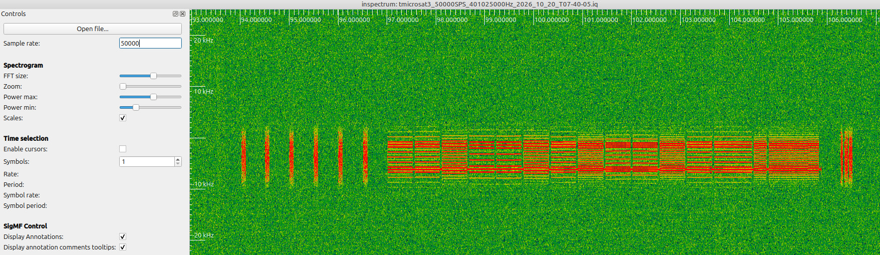
T.MicroSat-3 and 4 are both alive. Just received over North Texas, EM12. Tron 4 signals appear stronger than Tron 3). 20261020_T12-40-05Z. Tron 4 playing Ode to Joy melody transposed into the key of G. Tron 3 also playing the music, albeit much weaker signal for this pass.
Frames uploaded to @satnogs . Congratulations to the teams!!
Good hunting all,
Bob
N6RFM
8 Likes
fredy
October 20, 2026, 1:24pm
13
Confirming also from Network observations that both T.MicroSats are alive, also the TLE for now looks pretty good. Will check tomorrow for any update.
7 Likes
K4KDR
October 20, 2026, 3:13pm
14
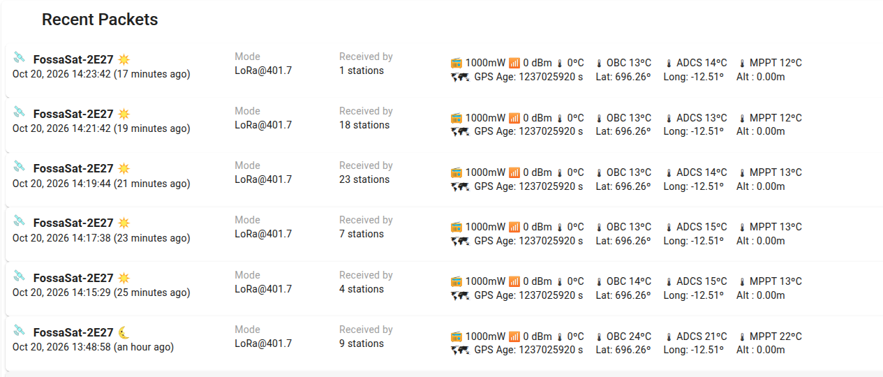
tinyGS also showing good packets from FossaSat-2E27 !
We’ll get a chance in the U.S. when the orbits cycle around tonight.
6 Likes
nowa
October 20, 2026, 8:47pm
15
https://sonik.space/observations/1669472/
Ode of Joy - two times in a row)
5 Likes
K4KDR
October 21, 2026, 3:26am
16
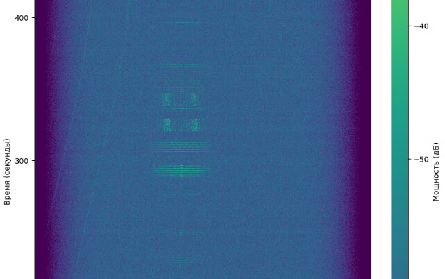
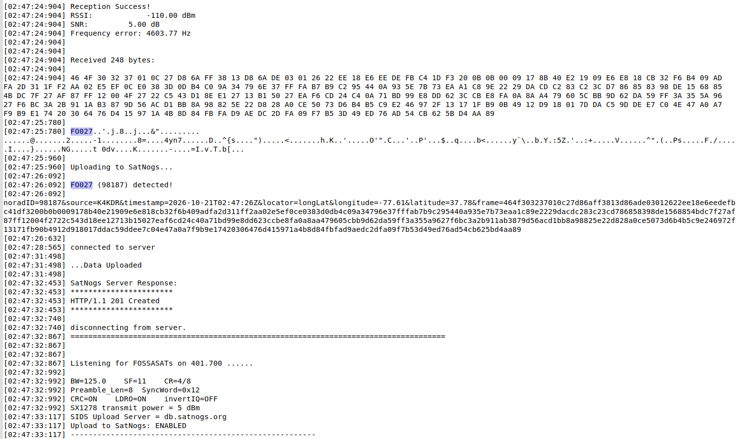
The BW-5 sats finally found their way over to the U.S. East Coast. Good copy on the LoRa downlink from FossaSat-2E27 !
https://x.com/scott23192/status/2112746709302517928
6 Likes
fredy
October 21, 2026, 12:56pm
17
Post launch TLE by celestrak.org :
TMICROSAT-3
1 72108C 26237A   26293.50090327 -.00001994  00000-0 -39124-3 0  9993
2 72108  52.9891 322.6870 0006783 281.0079  64.4595 14.91734813    18
TMICROSAT-4
1 72109C 26237B   26293.50110351 -.00001872  00000-0 -36741-3 0  9991
2 72109  52.9855 322.6873 0006139 284.2418  62.3090 14.91726337    18
FOSSASAT-2E27
1 72092C 26237C   26293.50136624 -.00000580  00000-0 -11369-3 0  9997
2 72092  52.9829 322.6867 0005507 284.2481  63.7203 14.91787331    13
TOMORROW-S15
1 72107C 26237D   26293.50139402 -.00000416  00000-0 -81185-4 0  9993
2 72107  52.9902 322.6847 0006455 273.6684  74.4358 14.91942545    10
TOMORROW-S14
1 72106C 26237E   26293.50156068 -.00000324  00000-0 -63330-4 0  9999
2 72106  52.9878 322.6846 0006096 277.9260  71.0788 14.91867507    12
IMPULSE-4 MIRA
1 72100C 26237F   26293.50164170 -.00000419  00000-0 -79269-4 0  9999
2 72100  52.9882 322.6842 0007068 225.9601 123.4789 14.93172888    15
HAWK-15C
1 72095C 26237G   26293.50175050 -.00001523  00000-0 -29515-3 0  9996
2 72095  52.9863 322.6841 0005523 261.8155  88.2122 14.92248474    16
SIRIUS-B
1 72105C 26237H   26293.50217642 -.00000892  00000-0 -16956-3 0  9995
2 72105  52.9858 322.6823 0006340 229.9511 122.3679 14.92995707    16
SIRIUS-A
1 72104C 26237J   26293.50252943 -.00000661  00000-0 -12556-3 0  9993
2 72104  52.9865 322.6806 0006605 229.9400 124.2752 14.93026818    17
HAWK-15A
1 72093C 26237K   26293.50270883 -.00000808  00000-0 -15370-3 0  9993
2 72093  52.9861 322.6798 0006512 231.2232 123.9567 14.92987276    19
HAWK-15B
1 72094C 26237L   26293.50299934 -.00000622  00000-0 -11835-3 0  9998
2 72094  52.9885 322.6784 0006816 233.7795 122.9582 14.92969229    13
ICEYE-X88
1 72097C 26237M   26293.50342642  .00000266  00000-0  51430-4 0  9994
2 72097  52.9878 322.6766 0005569 258.9091 100.1264 14.92309082    10
ICEYE-X110
1 72099C 26237N   26293.50357226  .00000453  00000-0  86340-4 0  9996
2 72099  52.9876 322.6759 0006512 236.3064 123.5134 14.92877941    10
PULSAR-02
1 72086C 26237P   26293.50374355  .00001304  00000-0  24873-3 0  9992
2 72086  52.9864 322.6752 0006288 236.3098 124.4333 14.92849092    10
PULSAR-04
1 72088C 26237Q   26293.50392295  .00001330  00000-0  25718-3 0  9995
2 72088  52.9864 322.6744 0005322 257.4208 104.2867 14.92327440    14
ICEYE-X109
1 72098C 26237R   26293.50402365  .00001940  00000-0  37017-3 0  9998
2 72098  52.9886 322.6740 0006614 238.4302 123.8145 14.92846358    14
PULSAR-03
1 72087C 26237S   26293.50407804  .00001445  00000-0  27898-3 0  9995
2 72087  52.9880 322.6738 0005628 256.1528 106.3854 14.92371971    11
ICEYE-X84
1 72096C 26237T   26293.50413476  .00000785  00000-0  15140-3 0  9990
2 72096  52.9847 322.6733 0005166 251.1264 111.7235 14.92438089    15
PTS-1
1 72114C 26237U   26293.50450050  .00000066  00000-0  12803-4 0  9996
2 72114  52.9883 322.6720 0005639 254.2283 110.5812 14.92413880    12
CAPELLA-21 (ACADIA)
1 72089C 26237V   26293.50451786  .00001560  00000-0  29762-3 0  9995
2 72089  52.9861 322.6717 0006246 236.1630 128.7447 14.92843021    14
PULSAR-01
1 72085C 26237W   26293.50466022  .00001935  00000-0  36962-3 0  9996
2 72085  52.9891 322.6714 0006612 240.6218 125.0444 14.92803068    13
FRG-100D4
1 72091C 26237X   26293.50471578  .00001248  00000-0  23866-3 0  9991
2 72091  52.9854 322.6707 0005997 238.6374 127.3350 14.92760994    17
STARBURST-1
1 72103C 26237Y   26293.50486045  .00000917  00000-0  17685-3 0  9994
2 72103  52.9887 322.6705 0005739 253.8341 112.9094 14.92431568    19
PTS-2
1 72115C 26237Z   26293.50520073  .00000604  00000-0  11569-3 0  9995
2 72115  52.9888 322.6691 0006399 243.1968 125.3759 14.92725223    17
PELICAN-12 3013
1 72102C 26237AA  26293.50523892  .00000743  00000-0  14236-3 0  9991
2 72102  52.9854 322.6683 0005867 240.6311 128.1541 14.92703141    15
CAPELLA-22 (ACADIA)
1 72090C 26237AB  26293.50525744  .00002036  00000-0  39205-3 0  9995
2 72090  52.9850 322.6681 0005255 248.1091 120.7768 14.92491696    12
GNOMES-11
1 72101C 26237AC  26293.50571115  .00002625  00000-0  50471-3 0  9993
2 72101  52.9894 322.6671 0006026 250.0141 121.3016 14.92544673    14
MAXWELL
1 72113C 26237AD  26293.50667064  .00002282  00000-0  43961-3 0  9990
2 72113  52.9885 322.6628 0005659 251.9698 124.5065 14.92467259    10
W-SERIES 7
1 72112C 26237AE  26293.50691254  .00002250  00000-0  43102-3 0  9999
2 72112  52.9888 322.6619 0006333 245.0723 132.7036 14.92688682    19
UMBRA-14
1 72111C 26237AF  26293.50774703  .00002960  00000-0  56917-3 0  9995
2 72111  52.9894 322.6587 0005949 250.5722 131.6889 14.92539050    19
UMBRA-13
1 72110C 26237AG  26293.50936508  .00004283  00000-0  82172-3 0  9999
2 72110  52.9850 322.6489 0005708 241.2730 149.6992 14.92630138    13
And here are the TLE from the above list for the 3 satellites that are in DB, changed to use the temporary NORAD ID:
TMICROSAT-3
1 98246C 26237A   26293.50090327 -.00001994  00000-0 -39124-3 0  9994
2 98246  52.9891 322.6870 0006783 281.0079  64.4595 14.91734813    19
TMICROSAT-4
1 98245C 26237B   26293.50110351 -.00001872  00000-0 -36741-3 0  9990
2 98245  52.9855 322.6873 0006139 284.2418  62.3090 14.91726337    17
FOSSASAT-2E27
1 98187C 26237C   26293.50136624 -.00000580  00000-0 -11369-3 0  9990
2 98187  52.9829 322.6867 0005507 284.2481  63.7203 14.91787331    16
1 Like
pe2bz
October 21, 2026, 2:54pm
18
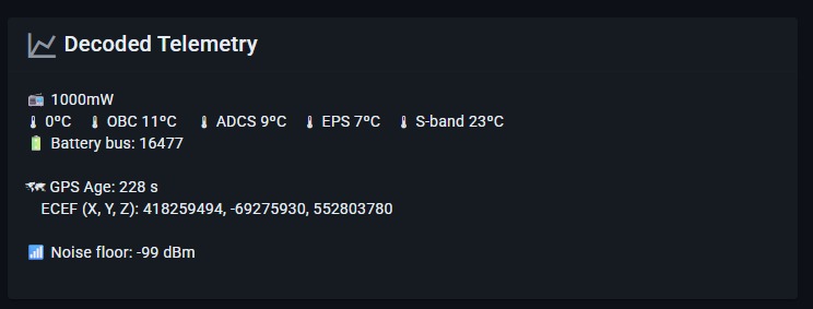
Fossasat-2E27 appears to be monitoring it’s S-band transmitter too ?
2 Likes
Hello,
We have a new TLE for T.MicroSat-3 (98246)
1 98246U 26999A   26294.27784491  .00000106  00000-0  50405-4 0    29
2 98246  52.9887 319.2758 0006809 282.8143 277.4630 14.91789645    21
and new TLE for T.MicroSat-4 (98245)
1 98245U 26999A   26294.19566667  .00000355  00000-0  16896-3 0    12
2 98245  52.9853 319.6377 0006193 285.0682 193.6482 14.91793020    18
2 Likes
K4KDR
October 21, 2026, 3:48pm
20
Since I wasn’t recording so early before last night’s expected pass of the BW-5 objects I can’t confirm, but it seemed to me that T.MicroSat-4 was running approximately 10 minutes of T.MicroSat-3 .
Is anyone else seeing this?