Satellites close to decaying
based on current TLE / Gpredict, altitude around 277 km
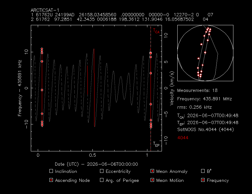
ARCTICSAT-1
1 61762U 24199AD 26158.03458560 .00000000 00000-0 12270-2 0 07
2 61762 97.2851 42.3435 0006188 198.3612 131.9046 16.05687502 04
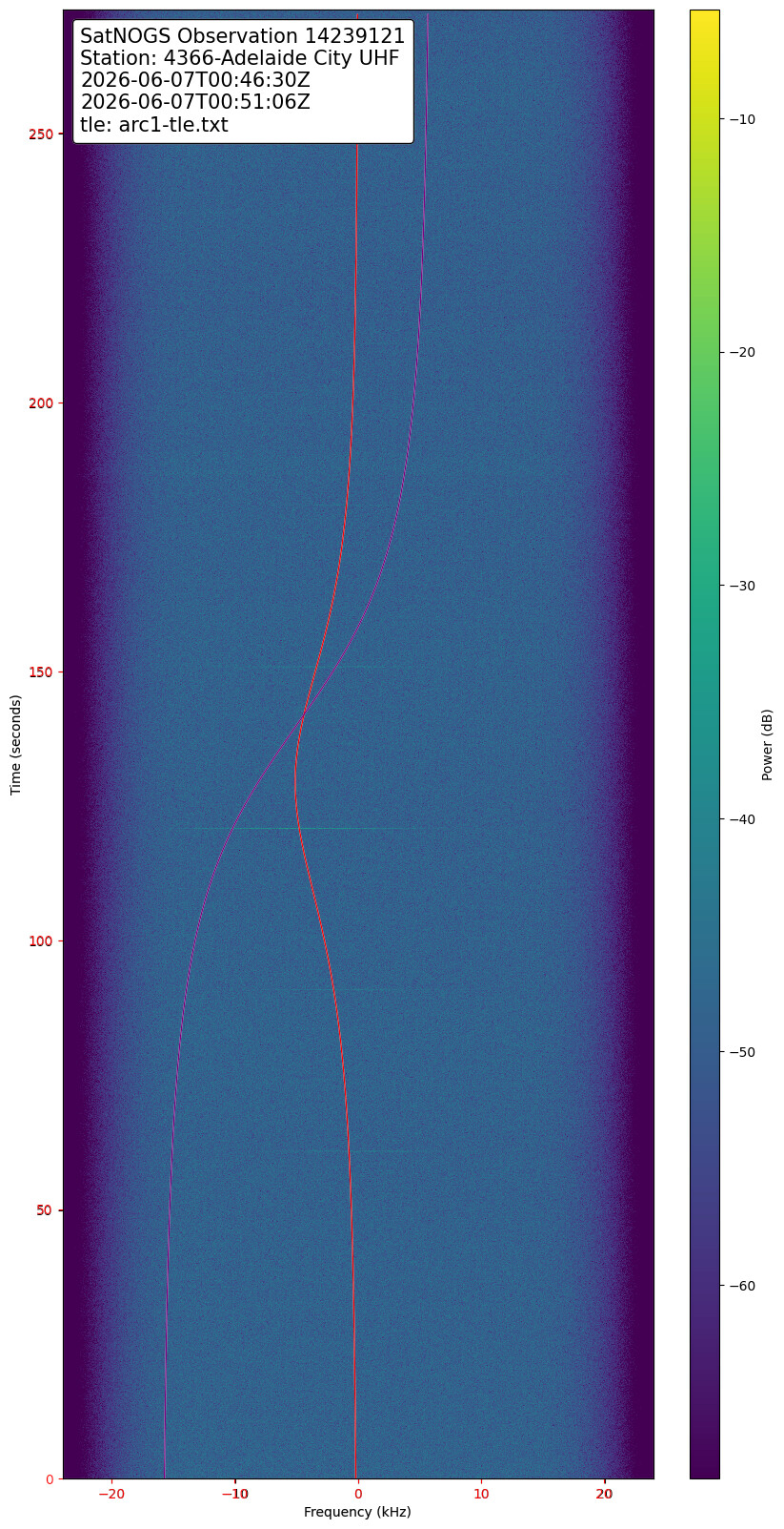
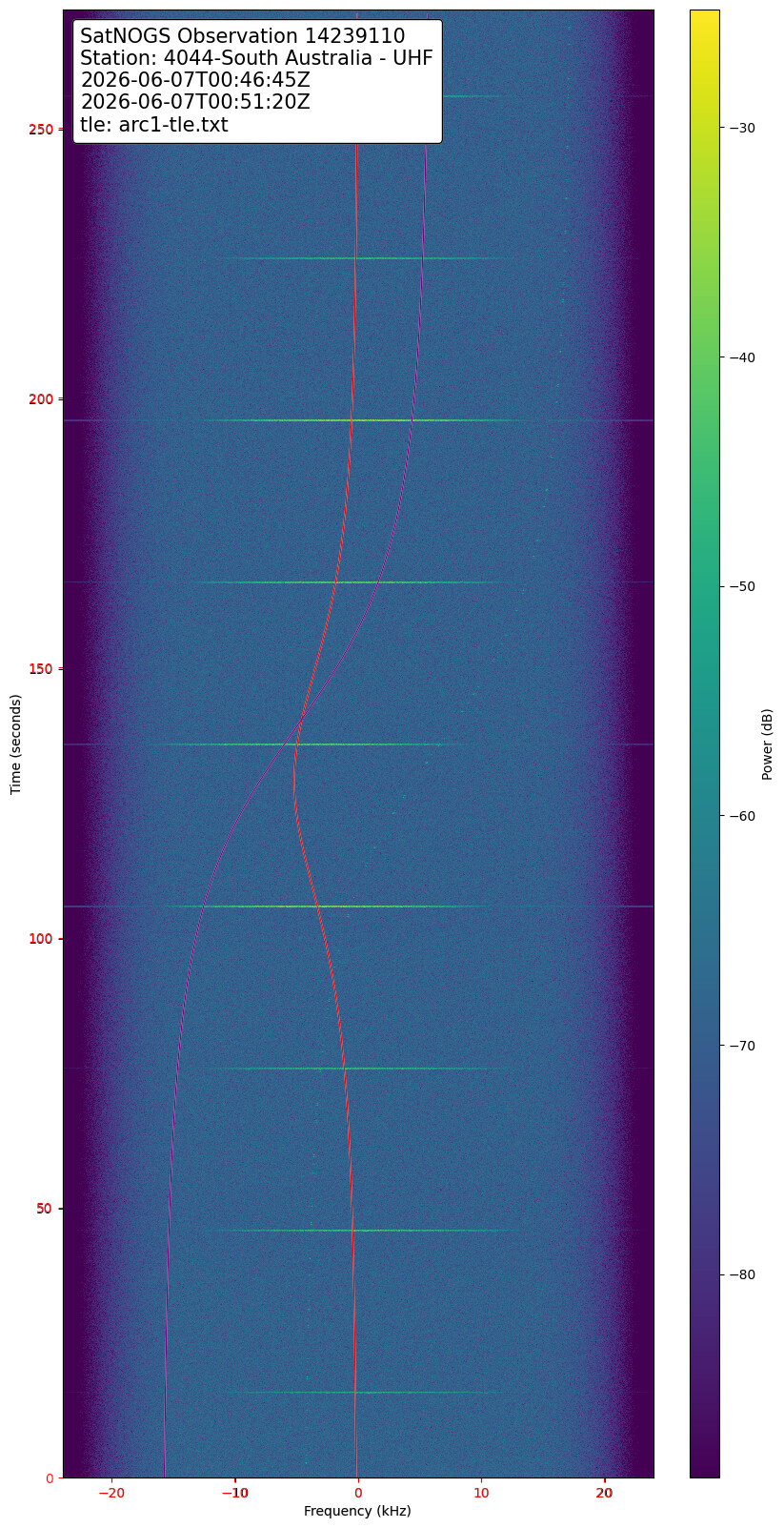
# 20260606.03-20260607.04, 18 measurements, 0.256 kHz rms
# 14239109_14239110.dat (total: 2 obs) (duration: 24 hours) (magic key: 256sfefef)
# generated using: https://github.com/hobisatelit/satno2tle (v0.03)
arcticsat1.zip (1.8 KB)
update:
ARCTICSAT-1
1 61762U 24199AD  26158.03458370  .00000000  00000-0  12270-2 0    06
2 61762  97.2851  42.8943 0006188 198.3612 131.8794 16.05624526    09
# 20260606.03-20260607.04, 18 measurements, 0.176 kHz rms
# 14239109_14239110.dat (total: 2 obs) (duration: 24 hours) (magic key: 256sfefef)
# generated using: https://github.com/hobisatelit/satno2tle (v0.03)
compare with June 5, drop around 1 km (based on gpredict)
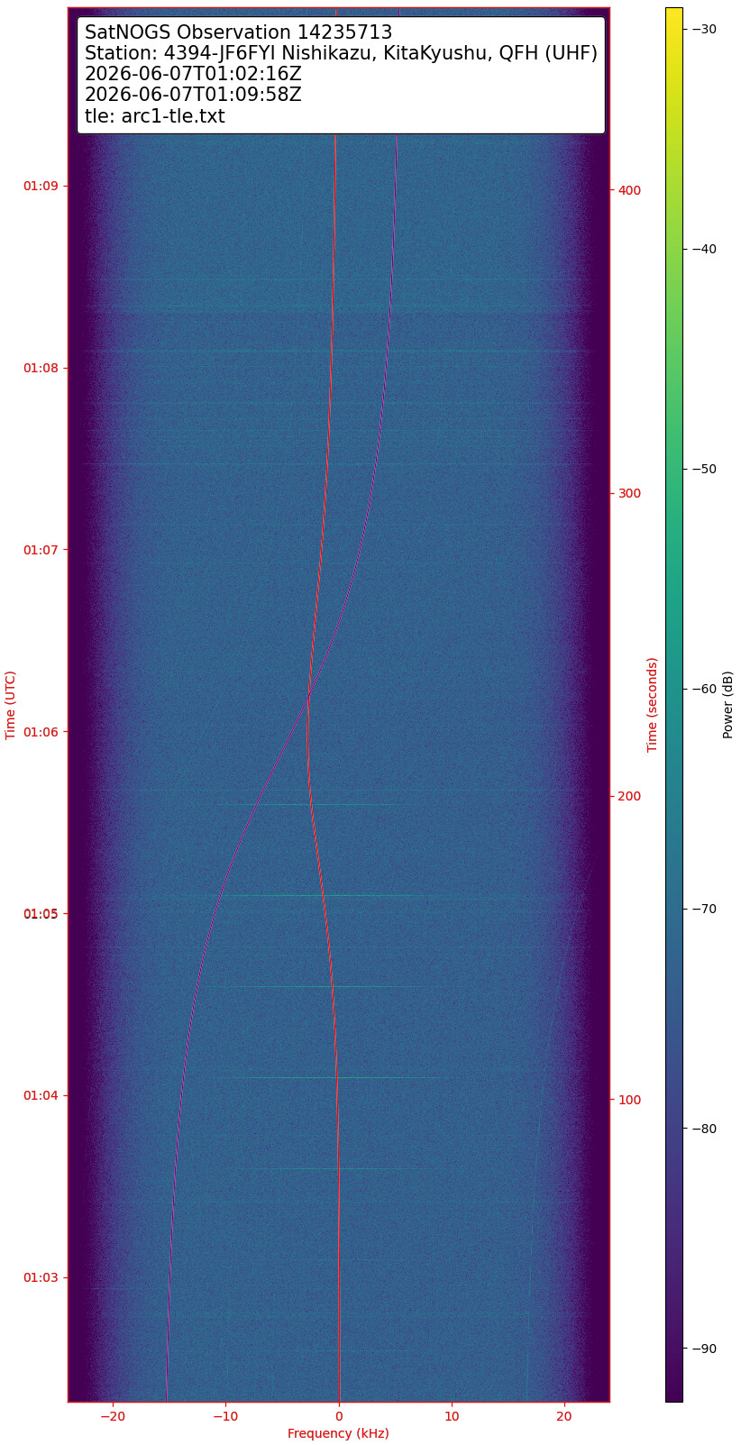
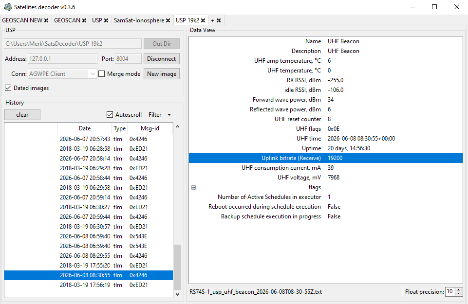
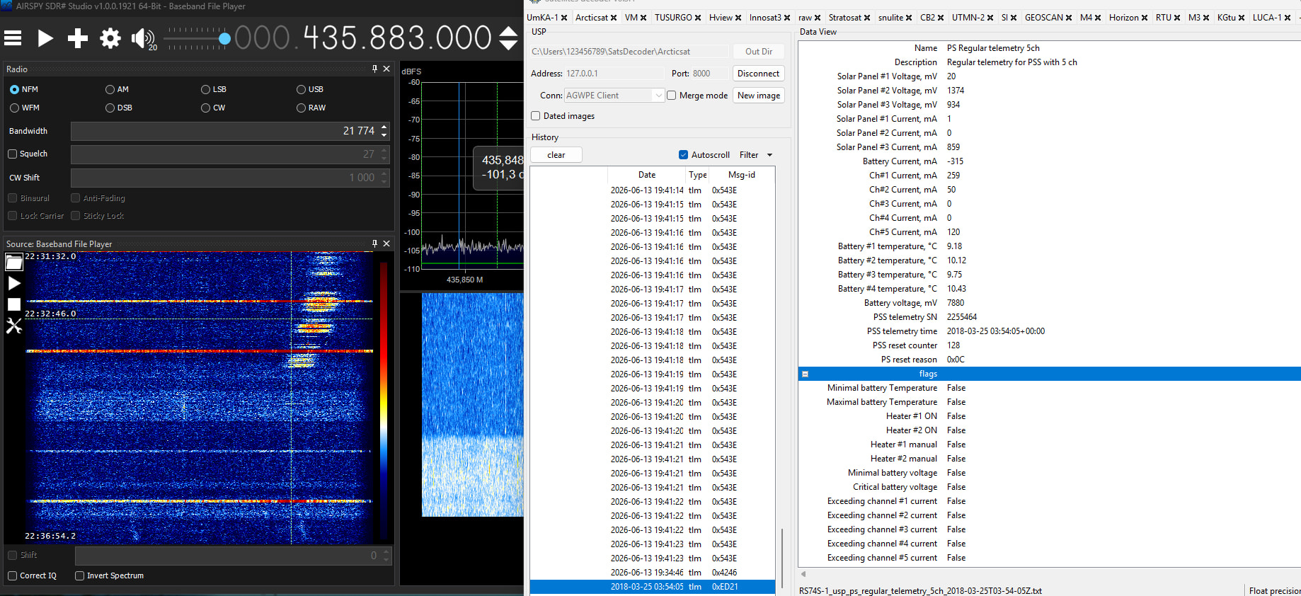
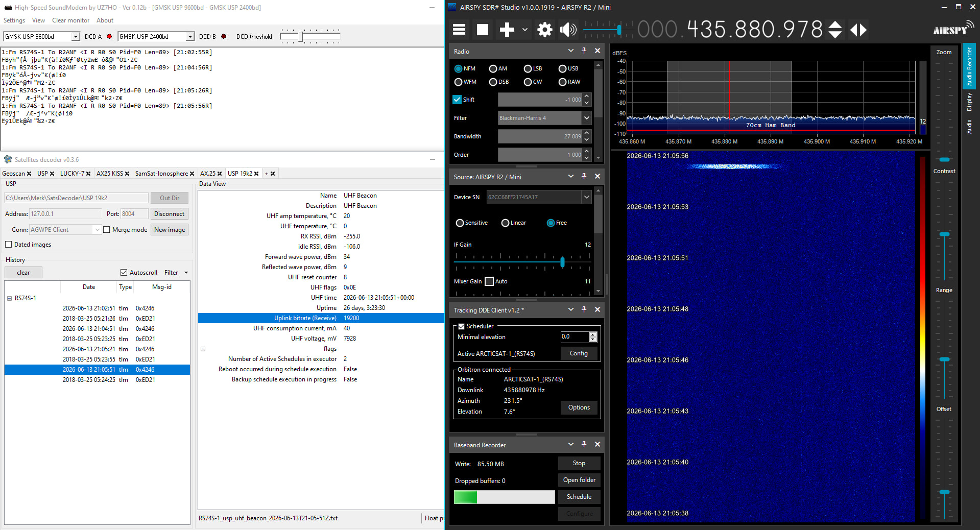
2026-06-08 08:30 UTC. Telemetry reception from the decaying ![]()
![]() ArcticSat-1 (RS74S) on 435.890 MHz, in GMSK USP @ 19200 bd. Current altitude ~260 km. Decay prediction: June 14, according to https://sonik.space/decay/
ArcticSat-1 (RS74S) on 435.890 MHz, in GMSK USP @ 19200 bd. Current altitude ~260 km. Decay prediction: June 14, according to https://sonik.space/decay/
Unfortunately, the operator announced that there will be no farewell SSTV broadcast ![]() Telegram: View @amateursat
Telegram: View @amateursat
current altitude around ~230 km
what i learn today about satellite altitude:
When measuring the altitude of a satellite from the ground, the satellite is actually at a lower altitude (closer to Earth) when it’s above the equator compared to when it’s near the poles.
This counterintuitive result happens because of Earth’s shape. Earth is an oblate spheroid — it bulges at the equator and is flattened at the poles. The equatorial radius is approximately 6,378 kilometers, while the polar radius is approximately 6,357 kilometers — a difference of about 21 kilometers.
Here’s what this means for altitude measurements:
At the equator: The ground surface is farther from Earth’s center, so a satellite in a given orbit is actually closer to the ground surface. If a satellite is in a circular orbit at a fixed distance from Earth’s center, its altitude (measured from the ground upward) is smaller at the equator.
Near the poles: The ground surface is closer to Earth’s center, so the same satellite in orbit appears higher above the ground. The altitude measurement is larger.
Practical example: Consider a satellite in a circular orbit 400 kilometers above the center of Earth’s surface (typical for low Earth orbit). At the equator, its altitude would be about 400 km minus the equatorial bulge, while near the poles it would be about 400 km minus the smaller polar radius, resulting in a higher measured altitude.
This is why when satellites maintain a constant orbital radius from Earth’s center, they appear at different altitudes depending on latitude — the equator experiences the closest approach, while polar regions experience greater distances.
based on video that i made, the difference = max 245 km - 224 km = 21 km !!
this explain why gpredict altitude is fluctuative , and why some latest cubesat re-entry near india (around equator).. btw based current satno tle, at 14 , arcticsat maybe will be re-entry between japan and australia (around 195 km). just maybe
script to update time:
update-time-forward.sh.txt (607 Bytes)
Hmmm… I wanted to think that the non-perfect-sphereness of the earth was some pretty complicated math and gpredict wouldn’t address that, and Eccentricity was a more likely explanation. But Ecc only accounts for 1.2km of change at 400km, and our specimen ArcticSat is well below that.
Color me impressed.
ArcticSat-1 is about to re-enter (few hours), let’s try to track it until its last orbits!
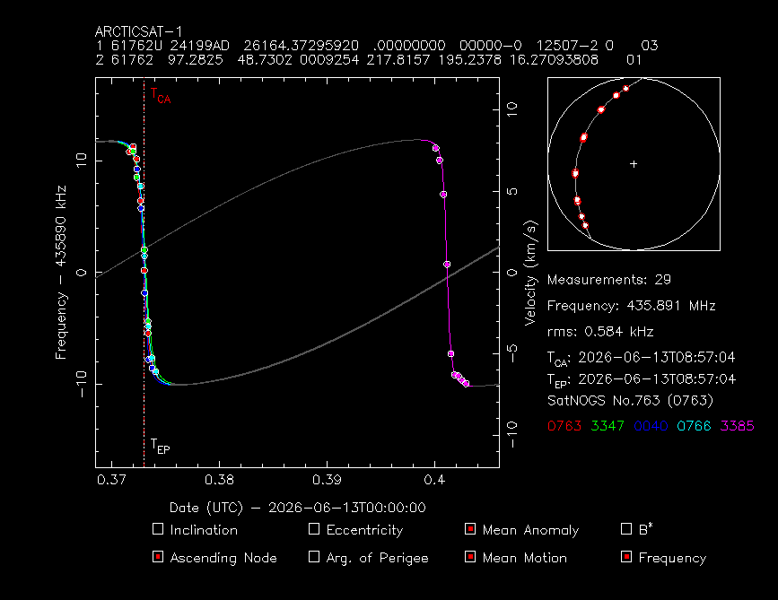
ARCTICSAT-1
1 61762U 24199AD  26164.37295920  .00000000  00000-0  12507-2 0    03
2 61762  97.2825  48.7302 0009254 217.8157 195.2378 16.27093808    01
# 20260613.37-20260613.40, 29 measurements, 0.584 kHz rms
# 14288727_14288921_14288720_14288728_14288640.dat (total: 5 obs) (duration: 0 hours) (magic key: manual)
# generated using: https://github.com/hobisatelit/satno2tle (v0.03)
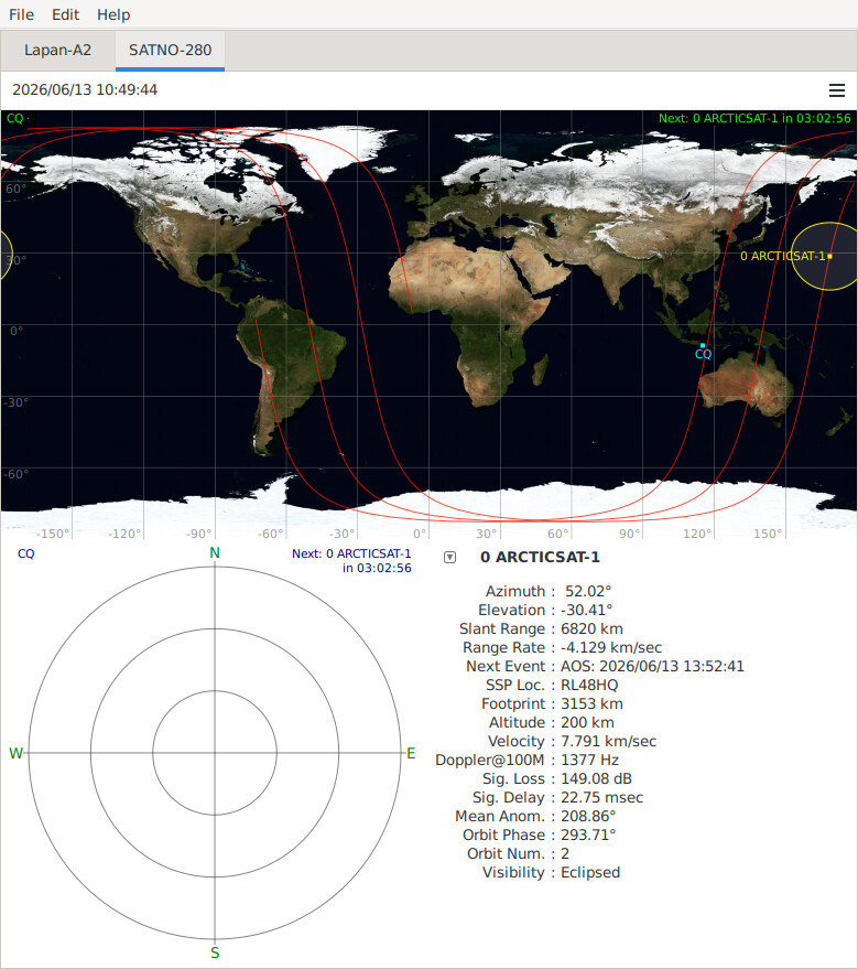
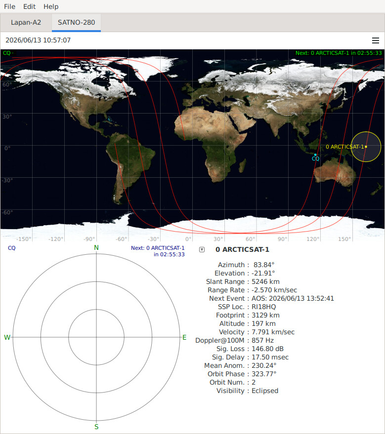
prediction base on gpredict and custom tle. the first under 200 km will start from east coast japan toward to australia
2026-06-13T10:49:44 (200 KM) — 2026-06-13T10:57:00 (197 KM)
One update on TLE after the latest passes:
ArcticSat-1
1 61762U 24199AD  26164.58064222  .00000000  00000-0  12978-2 0    07
2 61762  97.2825  48.8534 0009254 217.8157 332.5632 16.30601223    08
arcticsat_164_v1.dat (1.6 KB)
sites.txt (13.5 KB)
One more update, not very good accuracy as it is difficult to extract points from the waterfalls but I think it is close enough:
ArcticSat-1
1 61762U 24199AD  26164.73784004  .00000000  00000-0  13649-2 0    07
2 61762  97.2825  48.4254 0009254 217.8157 175.7798 16.40023362    06
sites.txt (13.5 KB)
arcticsat_164_v2.dat (1.9 KB)
A fix on the previous TLE:
ArcticSat-1
1 61762U 24199AD  26164.73830739  .00000000  00000-0  12978-2 0    08
2 61762  97.2825  48.7364 0009254 217.8157 178.4155 16.33761195    03
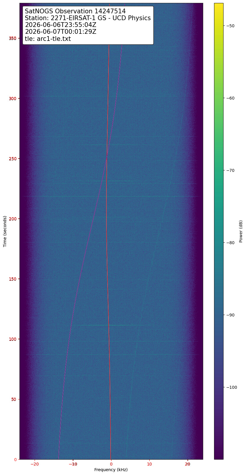
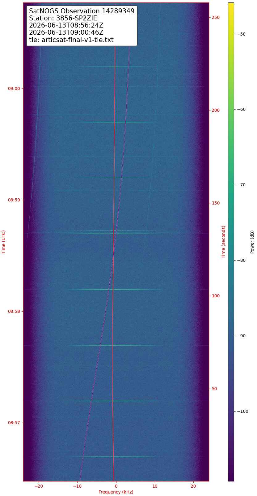
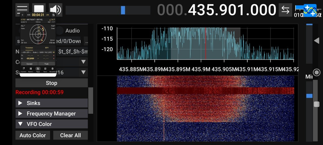
Arcticsat-1. 20:31-20:37 UTC. For me this might be the last data and telemetry recieved from the satellite.
Also got a backup observation at the same time using my ground station https://sonik.space/observations/1398622/
With the latest observations a much more accurate TLE set:
ArcticSat-1
1 61762U 24199AD  26164.87469327  .00000000  00000-0  12866-2 0    00
2 61762  97.2825  48.9894 0009254 217.8157 259.0250 16.32749266    09
arcticsat_164_v4.dat (1015 Bytes)
sites.txt (13.5 KB)
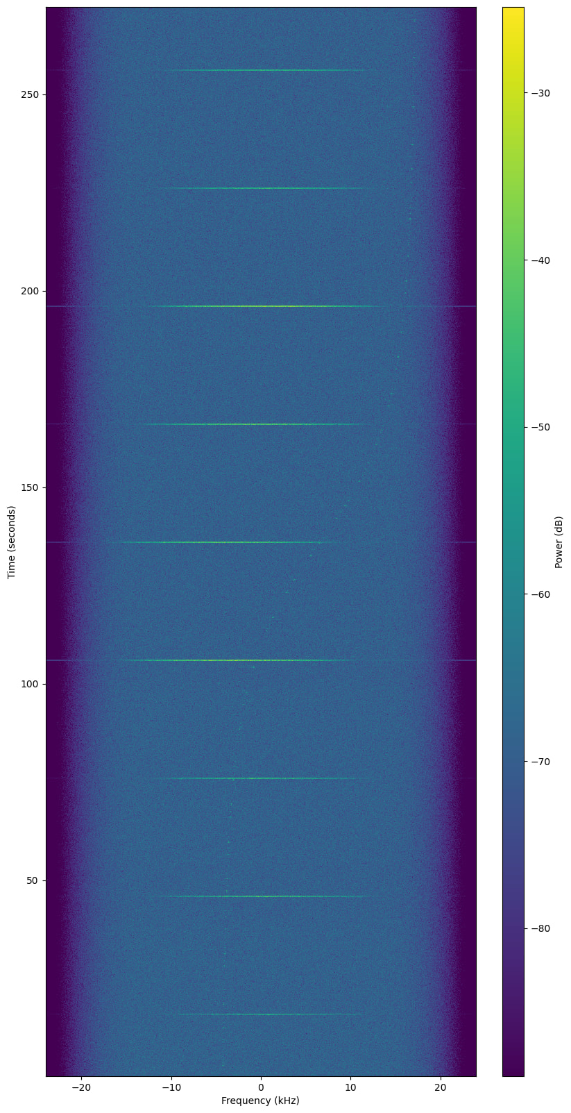
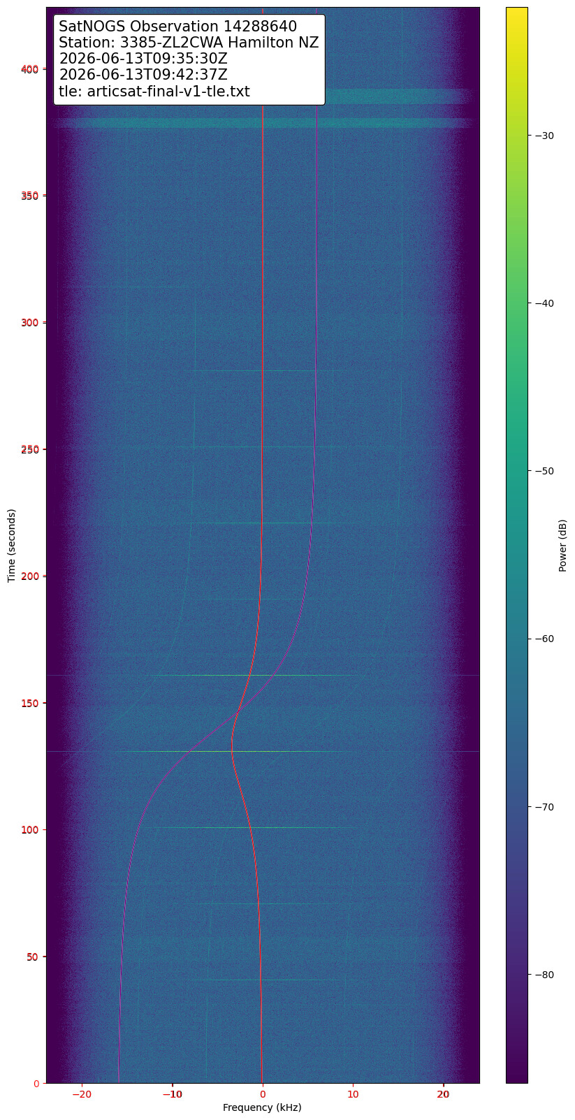
One (last?) decode from ArcticSat-1. Waterfall looks interesting at 197km.
Stefan/Oe6ISP
One more TLE update:
ArcticSat-1
1 61762U 24199AD  26165.03281939  .00000000  00000-0  12679-2 0    02
2 61762  97.2825  49.4225 0009254 217.8157 109.5600 16.37738262    00
sites.txt (13.5 KB)
arcticsat_165_v1.dat (2.1 KB)